Day 1: Obstanserseehütte-Zsigmondyhütte
| Distance | Up | Down | Time |
|---|---|---|---|
| 28.5km | +1450m | -1550m | 7.30h |
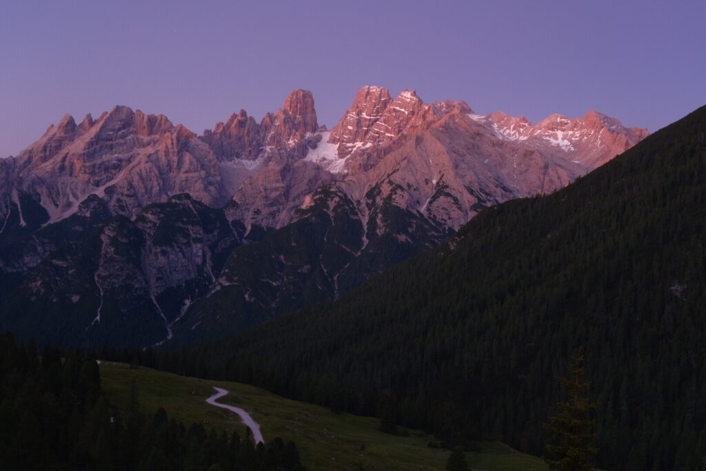
Today I leave the carnic alps behind and make a long walk into the Dolomites. From the shore of the Obstanser lake I climb up to the Sella dei Frugnoni a plateau on the ridge and borderline.
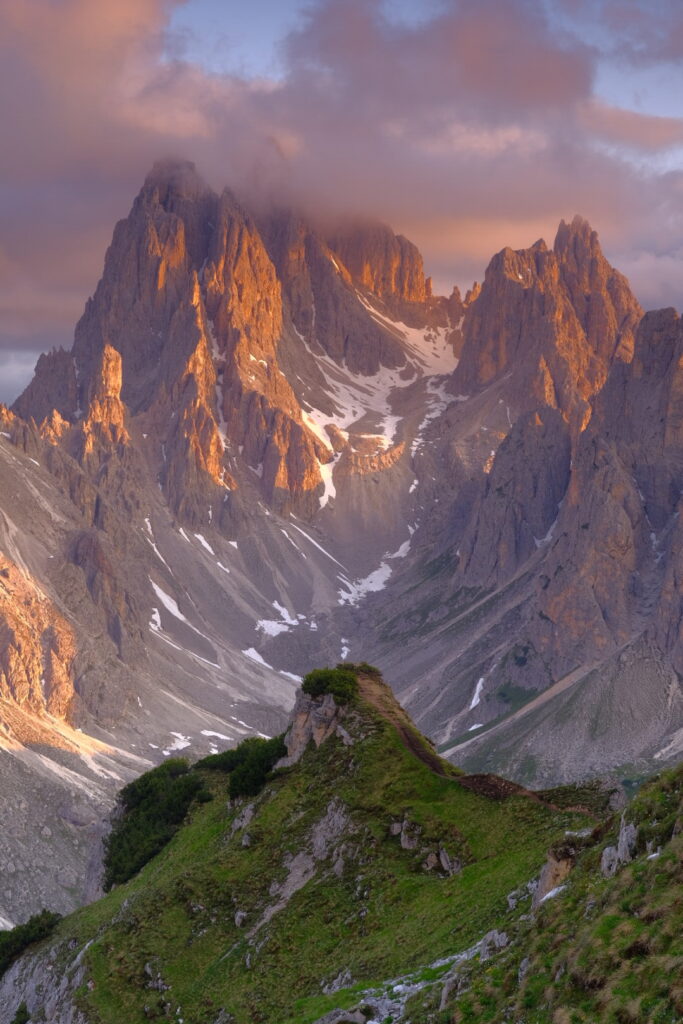
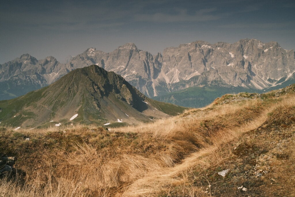 A great place for wild camping with splendid views to the Dolomites. My trail leads now into italy always with the eastern Dolomites in view. Under the burning sun I descend down until the Kreuzbergpass from where a long but soft uphill walk leads up to the Rotwandwiese. Another downhill section leads into the Fischleintal where I arrive after over 20km walking and many tourists come down to the valley after a visit to the Tre Cime di Lavaredo. I make a stop at the Talschlusshütte to resupply my body for the final ascent up to the Zigmondy hut. Its already 5PM when I head off and after total 7.5 hours I finally arrive at the mountain hut which is situated just below the imposing Zwölferkofel. This was probably the most demanding walk so far on the Via Alpina (together with the Triglav Seven Lakes hike) but also a very rewarding and beautiful one. I am again and again stoked by the Dolomites whenever I return. After three approaches from the Fischleintal through the Dreizinnenhütte I have to admit that the Zigmondy variant is much more beautiful, easier and way less overrun. Personally I think the view to the Zwölferkofel is at least as epic as the Tre Cime di Lavaredo and the Zigmondy hut is a much more authentic place for a overnight stay than the Dreizinnen hut and at least outside of weekend days pretty quiet, too.
Day 2: Zsigmondyhütte-Rifugio Auronzo
| Distance | Up | Down | Time |
|---|---|---|---|
| 11.5km | +650m | -550m | 5h |
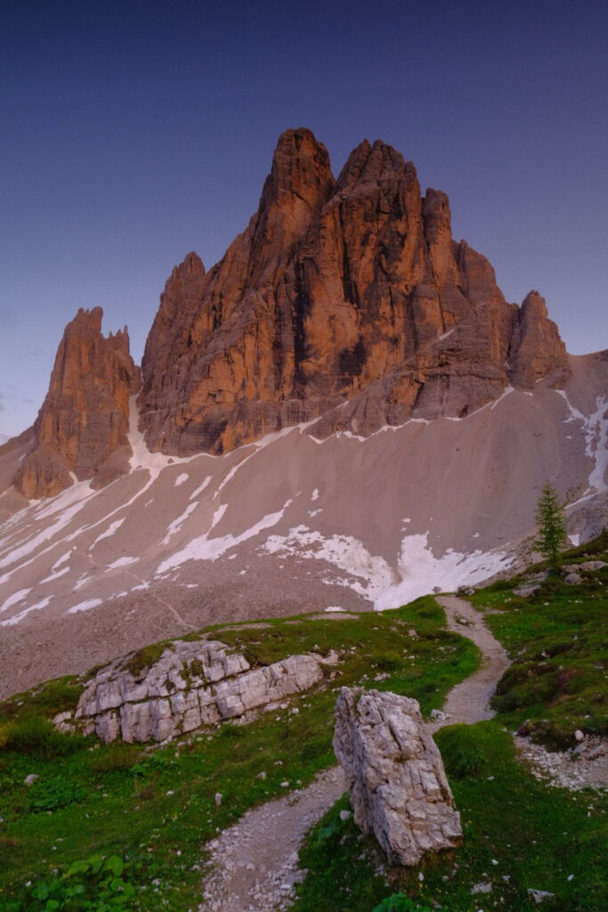
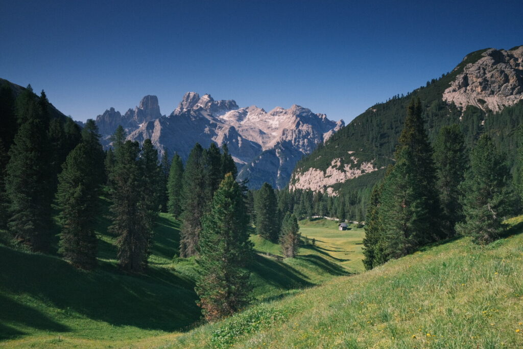
After my quite long and exhausting walk into the Dolomites of Yesterday its time to take a step back and cool down the engine. My plan is to tackle the Gamsschartensteig, climb to Paternkofel and finish with the Passportensteig. The first section runs uphill on a common mountain path towards the Büllelejoch hut and further up to the Seescharte. From here its very close to the Beginning of the Gamsschartensteig a very scenic via ferrata which was established during WWI with typical mountain bunkers. Here the first views to the Tre Cime from the east appear.
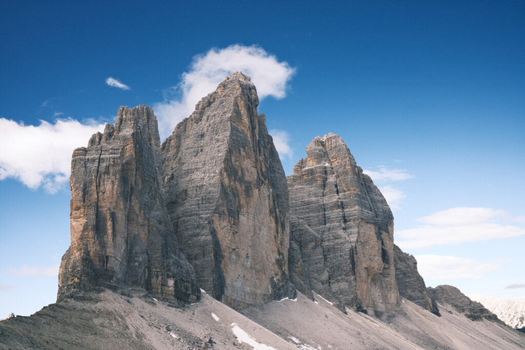
 At the Gamsscharte is the intersection of the Gamsschartensteig from the east, the De Luca Innerkofler Steig from the north and the Passportensteig from the south. From here some more climbing leads up to Paternkofel/Monte Paterno summit at 2744m above sea level with great views to the south walls of the Tre Cime di Lavaredo.
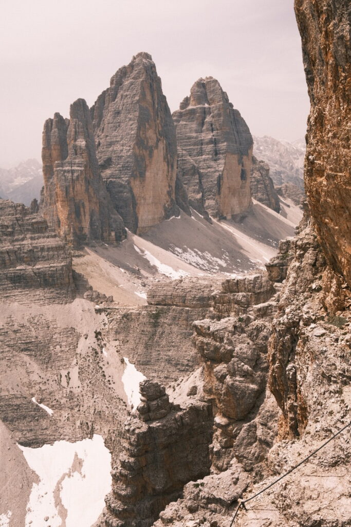
The nice weather seems to attract a lot of people and there is quite some traffic up to the summit. After enjoying the warm weather (around 10° Celsius!) and panorama I continue the descent back to the Gamsscharte. From here I follow the Passportensteig towards the Patternsattel/Forcella Lavaredo on the east side of the Tre Cime. From here its an easy walk around the Tre Cime until the Auronzo hut where a nice walking day with some easy climbing finds its end. Even tough this tour is suitable for beginners its no easy cake with a heavy trekking backpack on your shoulder. Without doubt a very scenic tour quite overrun tough already in middle of june.
Day 3: Rifugio Auronzo-Dürrensteinhütte
| Distance | Up | Down | Time |
|---|---|---|---|
| 20.5km | +850m | -1150m | 5.15h |
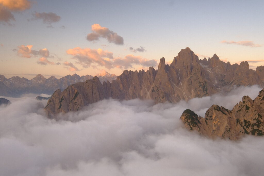
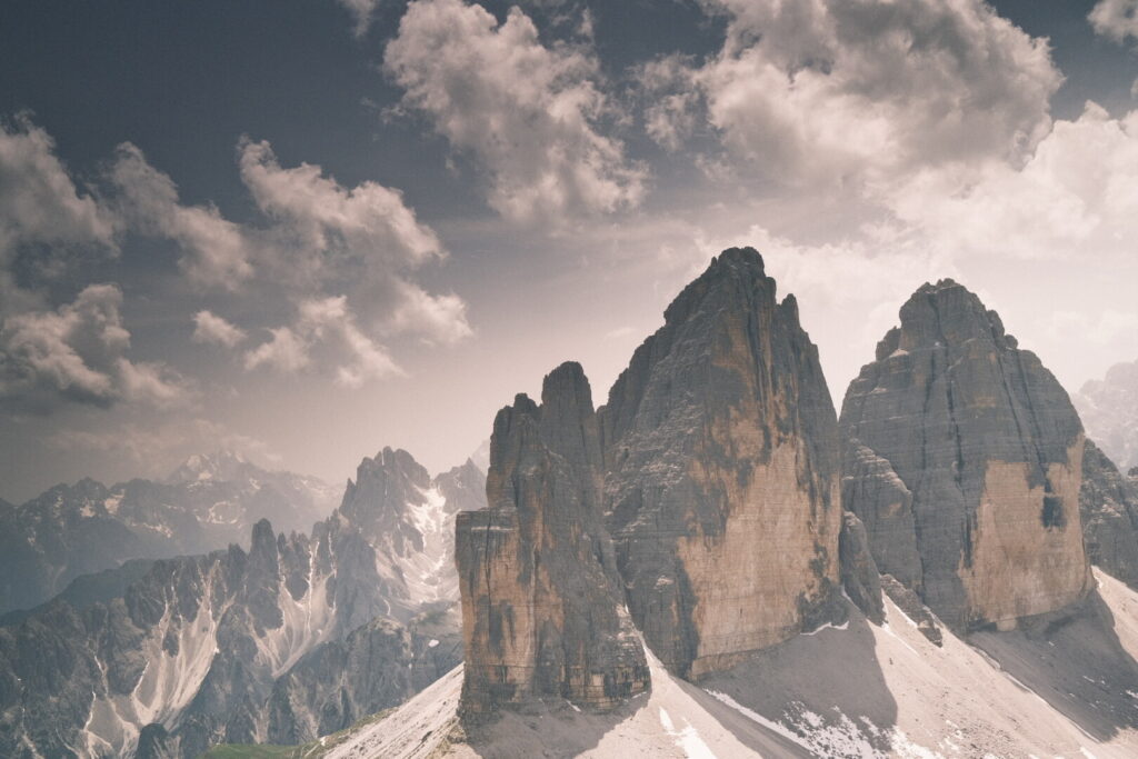
The past day brought bad weather with a lot of rain and strong winds through the whole day so I decided to skip my walking plans and do the second off-day in the first month on the Via Alpina. And it was a golden decision as I could recover and relax after some tough days in the carnic alps. After that intermezzo the sunny weather us back and I will enjoy another day around the tre cime and swing over to the pragser dolomites in the afternoon. Already by the early morning on this saturday many trail runners arrive at the tre cime as part of the event 120k Lavaredo as I notice by watching all the headlamp lights through the window from the rifugio Auronzo. Thousands will follow them during the next hours. Together with all the other crowds on a weekend day with perfect weather conditions the trails around the tre cime seem to explode. When I start my walk towards the Forcella Lavaredo and from there to the Dreizinnenhütte at 8 in the morning a strong and cold wind pushes against me on every step I take. The picturesque weather and the always present Tre Cime make me pick my camera again and again.
 At the Dreizinnenhütte I enjoy the sun before walking down the long descent into the Höhlenstein valley where I arrive at the Dürrensee with its inviting sand beach and a wonderfull panorama of the Cristallo group. I would love to fall down but I need to move on and get up to the Plätzwiese high above the valley. Luckily its a soft and pleasant climb to one of the most beautiful and calmest spots in the dolomites.
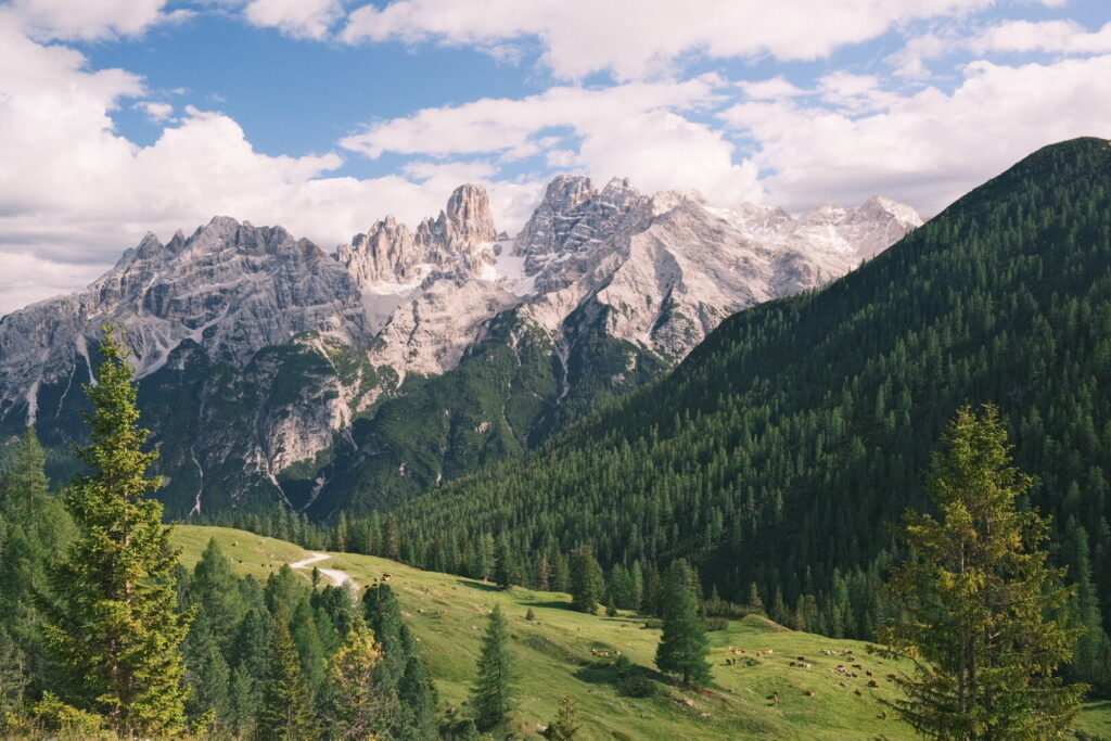 I’ve been here some years ago on my walk on the alta via 1 and have best memories of this area with its idyllic meadows surrounded by forest and alpine mountains which is also called sometimes the little Seiser Alm / Alpe di Siusi of the Pustertal. Like the last time I stay at the Dürrensteinhütte a very nice place with great food. Evi has now taken over from her mother and does a great job to make this place even more feel like a second home. After a filling dinner with barley-lentils soup and south Tyrolean dumplings the peaks of the Cristallo group are burning red.
Day 4: Dürrensteinhütte-Pragser Wildsee
| Distance | Up | Down | Time |
|---|---|---|---|
| 23km | +1050m | -1500m | 7.15h |
Like the day before its a clear morning and the whole day will be sunny and hot without any clouds on the sky. I am sad to leave this place where I fell in love.
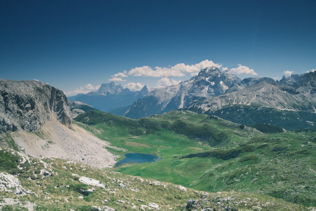
 The first part of the walk is a pleasant stroll along and through the meadows of the Plätzwiese before the trail climbs up to the base of the Croda Rossa / Hohe Gaisl. This magic mountain which can be seen from the tre cime area already and caught my attention already the first time I saw it from the distance many years ago. Surrounding the mountain the path runs through the area where 2016 happened a huge stonefall with 1.6 Mio cubic meter rock material thundering down causing an earthquake with a magnitude of 1.8. Walking on this section many memories of my first multiday hiking in the Dolomites arise when I walked on the Alta Via 1. Leaving behind the Rossalm at lunchtime which is packed with hungry hikers on this sunny sunday I climb up to the Forcella Cocodain through a dense karst field. From the pass a ridgewalk runs to the rifugio biella just below the Seekofel mountain. From this ridge you can enjoy a wide panorama over the whole Fanes-Sennes-Prags park and many peaks of the Dolomites in the distance.
 Being on the Alta Via 1 the area is typically very crowded and this sunday is no exception. Looking up to the Seekofel mountain I get up to the Ofenscharte from where the long descent to the Pragser Wildsee / Lago di Braies is initiated. Its a downhill scramble through an area with a lot of loose rocks and even the end of the day is coming closer it is still getting hotter. In the distance the blue colors of the lake are getting visible.
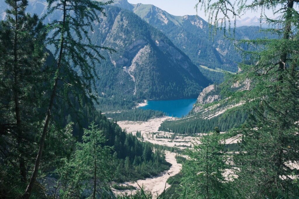 After a exhausting descent I finally arrive at the shore if the river where still many tourists walk around the lake or take take a swim. For Italians and tourists from around the world alike this place is a magnet and most of them seem to drive up here by car just for there Instagram selfie. Here you can perfectly observe the toxicity of mass tourism. Luckily its already evening time and the masses already went back to their hotel and I walk down a little bit from the lake to scout for a wildcamping spot. Just on the walking trail where almost nobody comes along as people get here almost exclusively by motorised vehicles I find a bench with table and a grassy spot next to it in the forest.