Day 1: St. Bernardino-Pian Grand
| Distance | Up | Down | Time |
|---|---|---|---|
| 9.5km | +900m | -200m | 3h |
I take down my tent on the edge of the Camping in St. Bernardino and move on. I am getting offered coffee and as usual I need to decline it without being able to pronounce a reason with my limited Italian vocabulary. The routing between Passo della Serraglia and Bocchetta de Trescolmen through San Bernardino is a self tailored variant of mine which was born out of different reasons (bad weather, resupplying food, going off the beaten track and staying at the altitude). On my way out of St. Bernardino I stocked up my groceries supply on the Migrolino shop and started the ascent towards the Pian Grand. Walking through the forest slightly uphill forvone hour to the Alpe Ocola above the tree line. Looking back towards the San Bernardino pass the striking and sharp shaped mountain range of Uccello and Cavriola attract my attention. The trail continues now steeper towards the Arbeola alpine pasture where I arrive after one more hour and a barking sheepdog says hello. After 3 hours I arrive at the Rifugio Pian Grand with perfect weather. 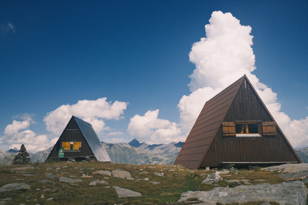 The unattended self-catering rifugio consists of two roof-only huts: one with a perfectly equipped kitchen with a big table and attached sleeping area offering 13 beds and another with 6 beds. In the kitchen I find some left over food allowing me to prepare a vegan dish in the evening. The rifugio is mainly used by hikers walking the 50km multi-day trek Sentiero Alpino Calanca running on the main north-south ridge of the mountain range that separates the south Graubünden valleys of Calanca and Misox. During the afternoon 5 hikers arrive at the hut who will spend the night here together with me and early in the evening a heavy thunderstorm hits the mountain range.
Day 2: Pian Grand-Alpe d’Örz
| Distance | Up | Down | Time |
|---|---|---|---|
| 24km | +1500m | -1800m | 7.30h |
 Close to the lake lays the Bocchetta de Trescolmen where I rejoin the official Via Alpina route. From here the descent runs through the Val Largé along the mountain stream Ria de Campalesc until reaching the narrow and steep Calanca valley ground at the settlement if Valbella.
 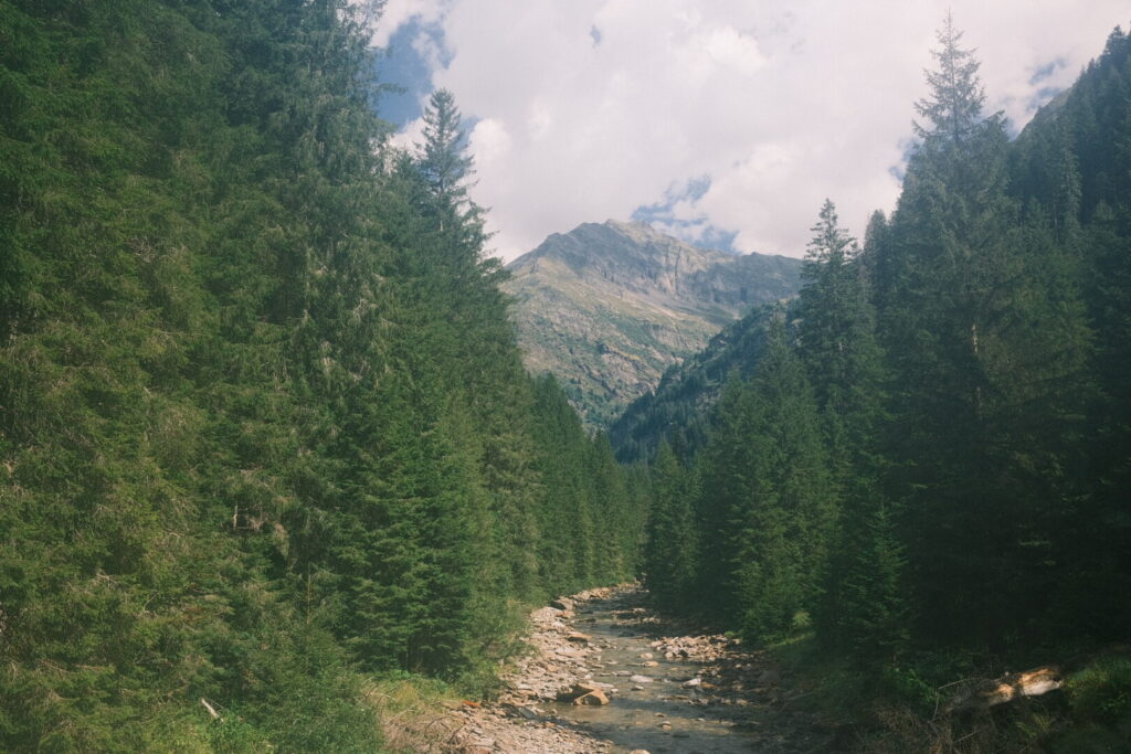 The upper part of the Calanca valley is natural and almost untouched by humans. I follow the small valley road going down the valley southwards always next to the Calancasca wild water river walking through places called Rossa, Augio or Santa Domenica. Like in the Misox or Poschiavo valleys in Graubünden/Grisons Italian is spoken in this valley, too. The Via Alpina route follows the Calancasca river further down through Cauco to Selma while I decide to climb the valley in its western side going up the road to Masciadone a quite abandoned place. From here a steep path climbs up through the forest with an incline up to 40%. Around 800 metres above the valley floor I reach the small farm Piöv di Fuori and have a short talk with the owner which surprisingly speaks german with some eastern swiss dialect. A serious thunderstorm is passing by at a frightening close distance to the north and will apparently hit again the mountain range on the other side of the Calanca valley. I decide to continue my ascent up to the Bocchetta di Pianca Geneura, a saddle between the Cima Oerz & Piz di Campedell mountains, under these risky conditions but the radar confirms that only the edge of the storm should touch my path. Walking further uphill I can observe the thunderstom hitting the opposite mountains in the east while I am only affected by some rain. The trail runs through the Galbines valley just below some rock walls a favourite place of the goats by the Piöv di Fuori alpine farm. Arriving at the saddle fog is pushing up from the other side creating a mystic atmosphere together with the growling thunder not too far away.
 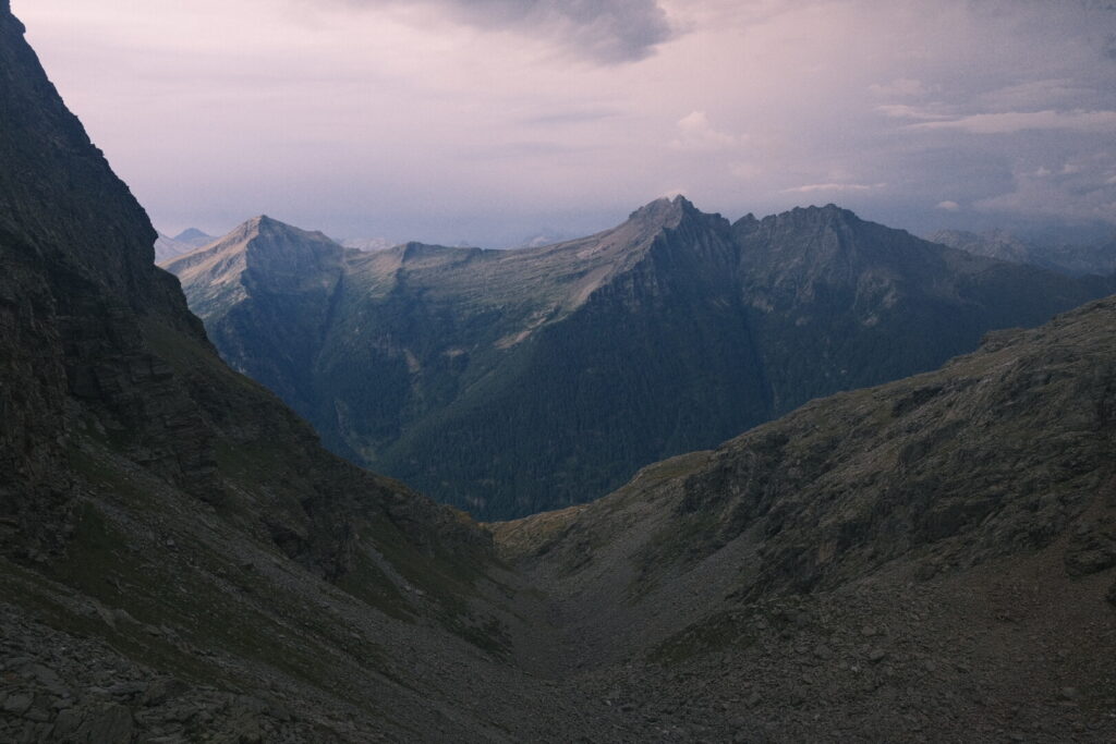 Through the fog and rocky underground I descent into the Ticino towards the Alpe Oerz where a a former alpine pasture and a rustic hut built with natural stone is used as unattended rifugio. Its located on the uppermost part of the striking beautiful Osogna valley which can be overlooked like from a balcony and next to the hut is a waterfall of the Nala stream which origins just some meters above.
 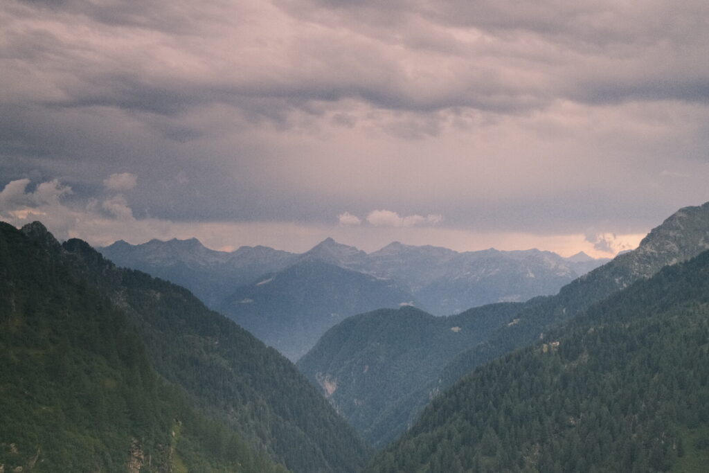 The hut is rather kept under the hood and even the farmer of Piöv di Fuori was not aware of it so most probably you will spend the night there alone. There are six beds, a well equipped kitchen and beer & wine (as usual in self-catering huts across the Ticino) which can be bought for almost the same prices like in the super market down the valley. Its already getting dark outside and I am tired of a long and exhausting walking day. I prepare a meal for dinner and after fall asleep pretty soon.
Day 3: Alpe d’Örz-Biasca
| Distance | Up | Down | Time |
|---|---|---|---|
| 16km | +50m | -1800m | 4.15h |
The Via Alpina stages through the Ticino are characterised by some serious altitude difference awaiting me every day and a heatwave bringing tropic temperatures for one week. I am expecting a challenging week at the limits. Before the temperatures hit the roof some torrential rain is announced for today so I decide to shorten the stage by directly descend to Biasca through the Osogna valley instead of going through Passo del Mauro following the official Via Alpina route. This would add another approx. 500 metres of altitude difference resulting in a total of 2300 metres going down. Moreover shortening the walking time by this faster route could save me from the rain which is to be expected earlier or later during the afternoon. When leaving behind the rifugio Oerz the sun is still hidden behind the steep walls of the Torrent Alto mountain and its seven peaks. The trail leads down steep through rocky grasslands following the Nala stream and its smaller waterfalls. 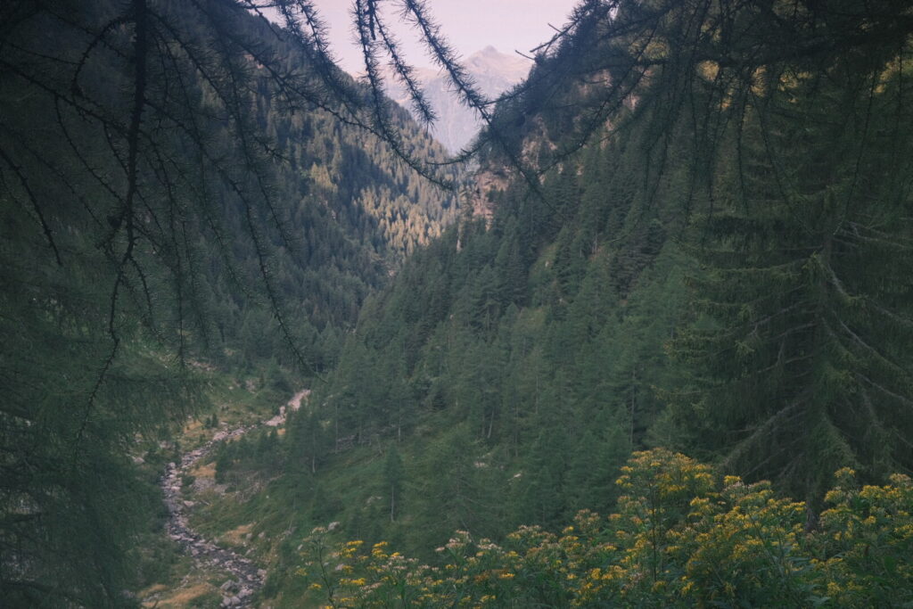 After heading down for some time the path enters the woods and we are walking through a sleepy and remote settlement in the upper Osogna valley. It seems I just time travelled some centuries back. An old lady offers me a beer and its barely 10 o’clock in the morning. The trail dives deeper into the Osogna valley along steep rock walls where ancient stone stairways are the only safe passage. This old path also leads over a stone arch bridge with a small waterfall and a pool from where the water flows below the bridge to fall deep down into the gorge.
 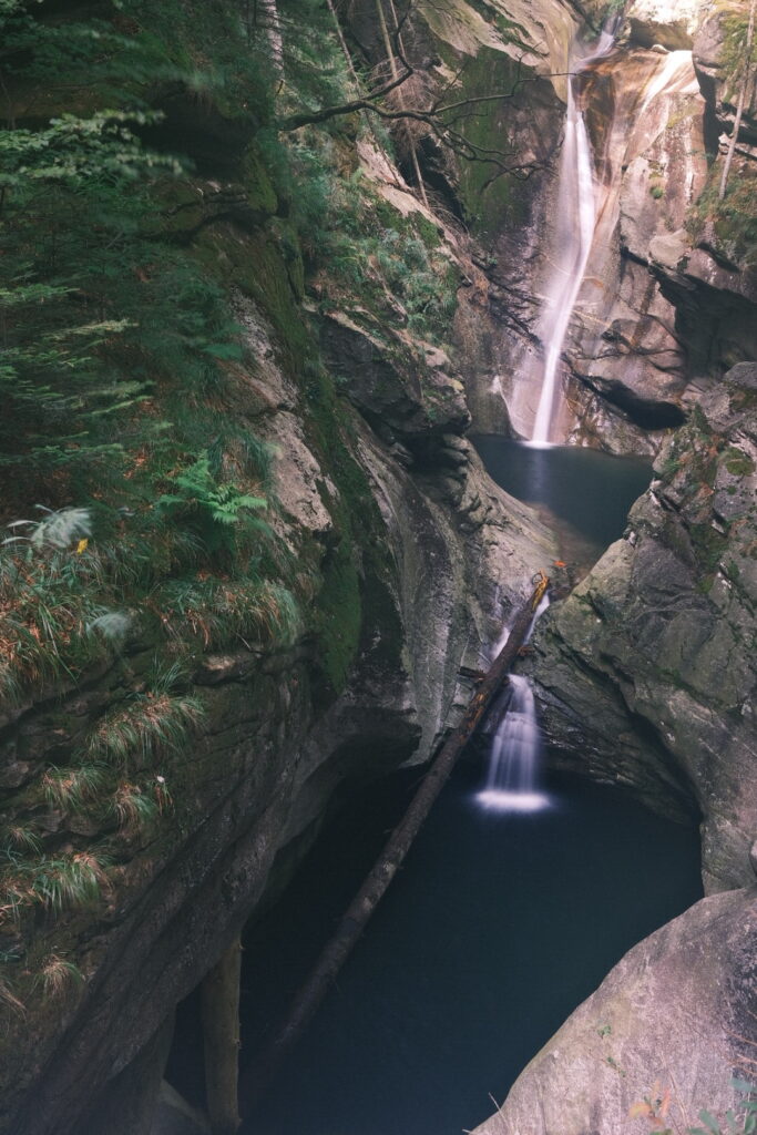 The temperatures are rising fast by heading down into the wide Riviera valley where the Ticino river flows like a snake between Biasca and Bellinzona. Arriving at the Riviera valley floor at the Osogna town around noon its incredibly hot and humid. With an altitude of below 300 metres above sea level it might be one of the lowest points apart from the seaside stages at the very begin and end of the Via Alpina. The remaining 5km walk through the Riviera valley along the Ticino river to Biasca is tough under these temperatures and no shadow. I am released to finally reach Biasca where the Leventina and Blenio valleys come together. As Biasca is the only place on my route through the Ticino with grocery stores I need to stock up for up to one week. I spend the night in a rather run down hotel just opposite of the train station.
Day 4: Biasca-Capanna Efra
| Distance | Up | Down | Time |
|---|---|---|---|
| 21km | +2000m | -300m | 7h |
This stage of Today will probably be one of the hardest. A long uphill valley walk with an ultimate steep ascent to the Gagnone pass connecting the Leventina and Verzasca valleys. 2000 metres uphill with a fully loaded backpack of 20kg and tropical temperatures. A day to push your limits. I leave Biasca as early as possible to walk with the morning shadow through the Leventina valley to Personico where the trail into the Ambra valley starts. These first 6km are rather boring and flat but I already feel the weight of my backpack. At the Personico settlement you could and should refill your water bottles before attempting the long 14km uphill walk which brings you up from 300 metres to 2200 metres above sea level. The first 10 kilometres are quite pleasant regardless the long distance thanks to a merciful incline and because the trail runs mainly through woods cooling down the heat. You even pass by a beautiful waterfall deep in the forest with a small pool. 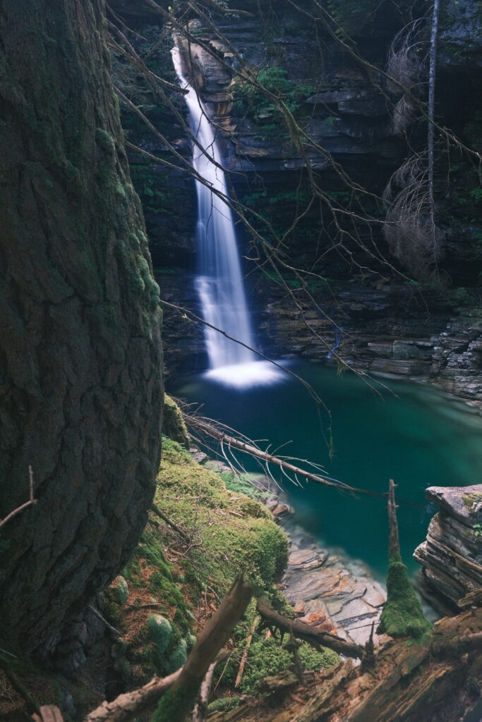 What an idyllic place which almost makes you forget about the arduous walk still laying ahead. Moving ahead we are reaching the end of the wood and approaching what seems the end of the valley. From here the trail winds up for the last 800 altitude metres to the Gagnone pass. The path is steep and overgrown which makes almost every step exhausting especially under the burning sun and I take more stops as usual to look back down into the valley and take a deep breath.
 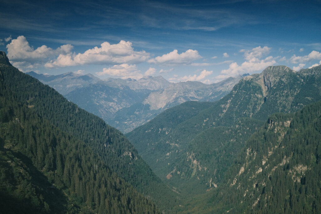 As I walk westwards and getting closer to the mountain ridge the sun disappears early behind the mountain lowering the temperature on the final ascent. After an endless walk I finally reach the Gagnone pass and the evening sun.
 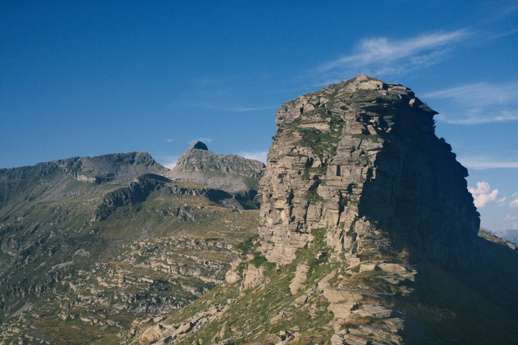 Looking down to the far away Verzasca valley I can spot the stone houses of the Capanna Efra where I will spend the night. After a short downhill walk I arrive at the mountain hut and I am relieved this demanding stage comes to an end now. The Capanna Efra is an unattended, self-catering mountain hut with all the luxury you could imagine in the mountains. A full featured kitchen probably more advanced equipped than back home, food and drinks, modern toilets & showers, spacious sleeping area with 25 beds and even running water & power outlets. Outside you even have some weak mobile network coverage. Surprisingly there are only 4 other people sleeping here on this Friday night. As the Efra mountain hut is an official stop on the Via Alta Valle Verzasca and the longer & more demanding Via Alta Idra multi-day trekking routes I am surprised there are not more people around.
Day 5: Capanna Efra-Capanna Barone
| Distance | Up | Down | Time |
|---|---|---|---|
| 21km | +1300m | -1150m | 6h |
My personally chosen Via Alpina routing through the Ticino will follow a simple logic during the next three days. Getting down between 1000-2000 metres into the valley during the morning and climbing up again the same amount to the next mountain range separating me from the following valley in the afternoon. This way I will traverse the Ticino Alps in 5 days overcoming around 12000 metres of altitude difference. If you’d had some extra time (add 2-3 days) you could opt to walk over the higher route along the Via Alta Idra between Capanna Efra and Capanna Corno-Gries (includes a T6 rated section on the last day). Today a rather pleasant downhill walk brings me down to the Verzasca valley. The first more alpine section of the descent brings me down from the Efra mountain hut to the Efra lake surrounded by larch trees. 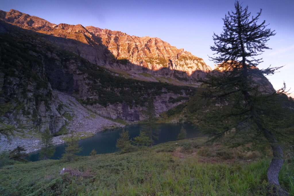 Further on its a pleasant and easy walk down to the Frasco village passing some typical stone huts along the way, too.
  Arriving the valley ground I walk along the Verzasca river to Sonogno the main touristic place in the upper Verzasca valley. From here the Via Alpina continues up into the Redorta valley and my plan was follow that route to stay at the Tomeo mountain hut during the night. As it is Saturday I called there as a precaution measure and indeed they are already fully booked. Checking the map I decide to change my route and follow the Verzasca river to its origin and climb up to the Barone mountain hut. These kind of last-minute changes are not always a good idea but today it will be only right decision I could have taken. Some kilometres after following a dirt road from Sonogno the mountain walking trail starts. The sun is burning and compared to the previous day not much of shade to cool down so the best strategy is to get off all possible clothes and jump into the river every now and then. Especially between the altitude of 1200 and 1300 metres the Verzasca river features a lot of smaller waterfalls and natural pools which invite to cool down in the refreshing water. Probably the most beautiful corner in the upper Verzasca valley on a hot summer day and due to its relative remoteness not too crowded. Until reaching a farm on a altitude of around 1500 the path is not too steep. The remaining 700 metres of altitude difference to the Barone Mountain hut are more demanding but not too difficult. In the valley I had checked the booking system of the hut and there are still 5 beds out of 35 available. As this mountain hut is on the intersection of three different Alta Via routes (Idra, Maggia, Verzasca) its quite crowded during the summer months of July and August especially on weekend days. Like the Efra hut the hut comes with quite some luxury: a fully equipped kitchen with food & drinks to buy and running water, modern toilets & showers, electricity and so on. I cook my meal already in the late afternoon just before the rush hour starts in the evening. Afterwards I climb up to the heart shaped Barone lake which is located nearby in a cirque below the Barone and Pizzo di Piancoi mountains.
Day 6: Capanna Barone-Rifugio Fiorasca
| Distance | Up | Down | Time |
|---|---|---|---|
| 22km | +1750m | -1750m | 7.45h |
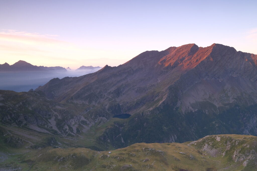
Today we are climbing the two mountain passes Bocchetta della Campala & Bocchetta di Fiorasca and cross the Maggia river over 1500m lover in altitude in between. Leaving the Capanna Barone behind we follow the alpine route of the Via Alta Valle Maggia to climb up to the Bocchetta della Campala on a truly alpine trail with some exposed sections but no real difficulties even it is rated as white-blue-white (T4). Reaching the pass somehow unexpectedly the Urner Alps and its highest peak the Dammastock can be seen in the far distance. Ascending down from the pass runs through a field of big rocks before reaching a more walking friendly underground which leads to a alpine pasture and the Prato valley. We follow this valley downhill to reach Monte de Predee where we rejoin the official Via Alpina route coming down through the Pertüs valley. From here a dirt road runs to Prato Sornico a small settlement on the Maggia river in the Lavizzara valley connected by the Locarno-Fusio road. I take a rest here and order a Marinara Pizza before attempting the climb up towards the Bocchetta di Fiorasca pass. The uphill walk runs first along serpentines through the shades of the wood and soon gently uphill along a paved road connecting different smaller settlements on the eastern hillside above the Lavizzara valley.  Towards 1500 metres above sea level a walking trail replaces the paved road to reach the Fiorasca saddle between the Pizzo Rosso and Pizzo Fiorasca on an altitude of around 2300m. Looking back the mountains we came from down in the morning on the opposite side of the valley are already pretty far in the distance.
  When reaching the saddle a group of muliple stone huts is already visible. The former Fioscara alpine pasture serves as a basic unattended rifugio nowadays with one hut equipped with a kitchen, running water and electricity, another one used as sleeping area with 10 beds and a smaller one with toilets and shower. Similar to the Alpe Oerz you will spend the night here alone in complete solitude far away from the busier alta via huts.
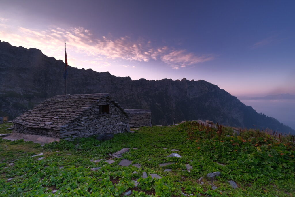
Day 7: Rifugio Fiorasca-Capanna Basodino
| Distance | Up | Down | Time |
|---|---|---|---|
| 22km | +1250m | -1450m | 6h |
Today the hottest day of the heat wave is awaiting me with a 8km stretch through the Bavona valley and temperatures around 30 degrees Celsius. After this valley walk another exhausting climb bring me up to the Robiei area at the foot of the Basodino glacier the highest mountain in the Ticino Alps. To start the day we walk down from the Fiorasca alpine pasture on a truly steep 30% descent into the Bavona valley. The trail runs along steep rock walls so better watch your steps. On an altitude of 1300 metres there are even growing oak trees on this rocky environment.  After a long descent going down around 1500m most of the time under the burning morning sun I finally arrive at Fontana in the Bavona valley. From here I start the valley section between Fontana and San Carlo. The valley is packed with tourists driving up to Foroglio to visit the famous Foroglio waterfall the highest and probably most impressive one in Ticino which was already visible from far above during my descent into the Bavona valley. Following the trail to the top of the waterfall and continuing a little further you would reach an arched stone bridge. I let the touristic scenery pass by and continue on my walk through the Bavona valley until finally reaching its last settlement San Carlo which serves as switchover to the cable car for most people arriving here by car or Postauto bus from Bignasco. If you watch people walking up from here to the Robiei area they are most probably walking the Via Alpina. The walking path runs gently uphill between narrow walls and most of the time far below the cable car which makes you feel somehow hemmed. Arriving at the Basodino hut I feel unsure to stay here overnight just because the environment feels too cramped to me but on the other hand I want to spend one night on an attended mountain hut in Ticino. Last but not least reaching the wild camping spot of my choice between the Robiei and Nero lakes would require another 500m uphill climb.
Day 8: Capanna Basodino-Nufenenstock
| Distance | Up | Down | Time |
|---|---|---|---|
| 17.5km | +1500m | -600m | 6h |
From the Basodino mountain hut a dirt road leads to the Robiei Cablecar station just below the Robiei reservoir dam. From here serpentines run steeply uphill to overcome around 300 metres of altitude difference until reaching some stone huts backdropped by the Basodino mountain and its wide glacier. 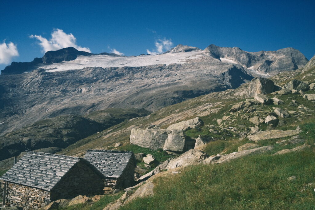 From here we constantly gain height and a mountain trail brings us to the Matörn mountain lake on an altitude of around 2450 metres above sea level. While walking on the Basodino always stays in eyesight. The Bocchetta di Valmaggia is already visible in the distance and about to be reached very soon. After climbing up the last metres to the saddle a truly beautiful view into the Formazza valley opens up in front of me with mountain lakes and mountain peaks. In the far distance the snow covered Finsteraarhorn and Schreckhorn peaks of the Bernese Alps are towering up.
 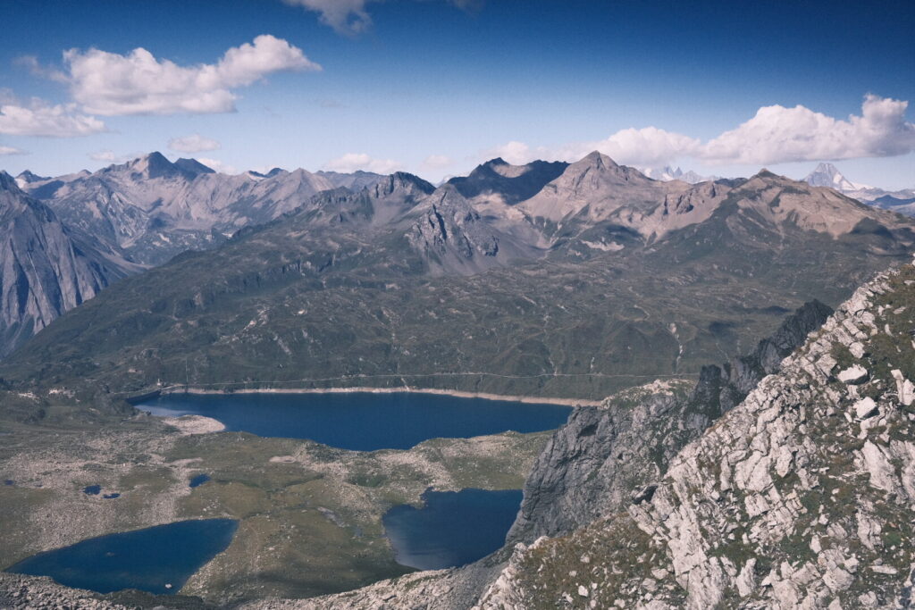 While the trail up to the saddle was pretty pleasant now a more demanding downhill parcours through rock fields is awaiting us to get down to the Boden lakes.
 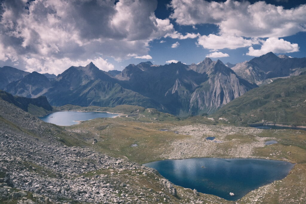 Arriving down at the lakes we have for sure left behind the solitude as the Formazza valley is a popular destination for Italians and with a good reason.
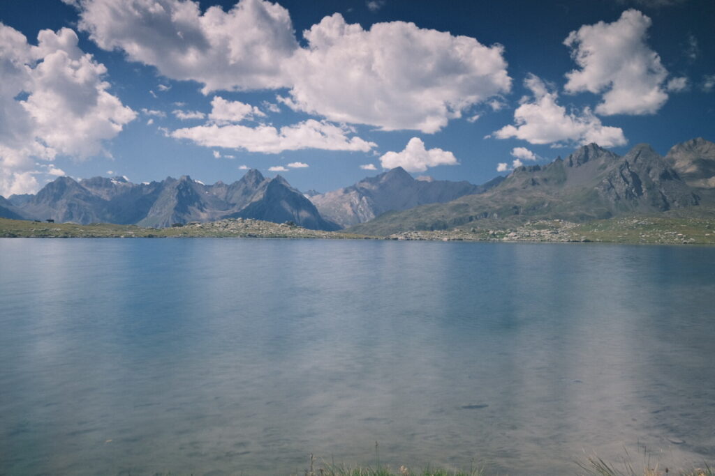
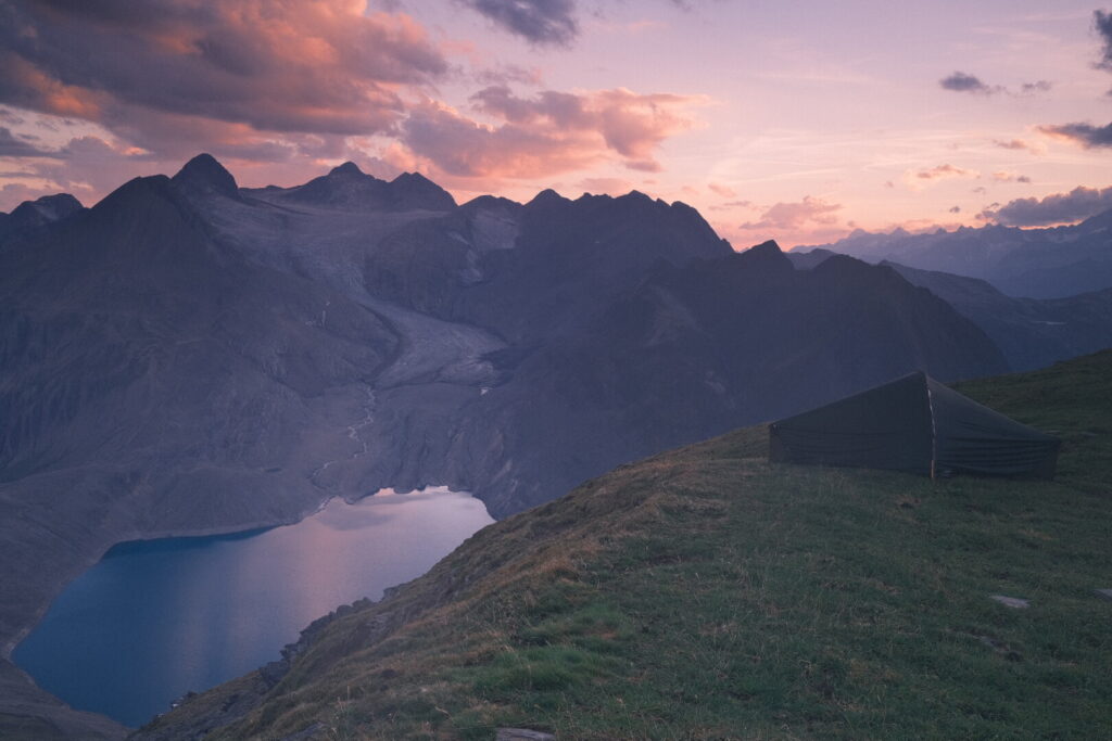
I decide to not follow the official Via Alpina route here which continues into the Formazza valley. Instead I will head to the San Giacomo pass back to the Ticino. This alternative avoids the masses and stays above the 2000 metres. After reaching the San Giacomo saddle and crossing the Italian-Swiss border for the second time within a few hours we enter the Bedretto valley which extends from Airolo to the Nufenenpass the main gateway between the Swiss cantons of Ticino and Valais. The walking trail is running westwards high above the Bedretto valley viewing down to the Nufenen pass road. 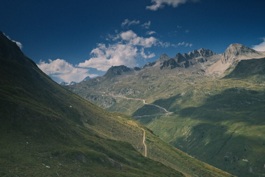 Climbing up gently the path traverses above the Bedretto valley directly into the Corno valley passing by the Corno-Griess where one could spend the night and continues towards the Corno pass on an altitude of 2500 metres above sea level just above the Griess lake. From here I climb up to the Nufenenstock a smaller mountain between the Griess lake and the Nufenenen pass offering splendid views to the Griess lake and its feeding glaciar. From the top you are also rewarded with splendid views in all directions which are mindblowing. There is no waymarked trail up the mountain but you can just follow the path which is clearly visible and runs close to the ridge along the Ticino-Valais border line. Just below the final ridgewalk to the summit on an altitude of around 2800 metres you can find some grassy spots to pitch a tent. This is probably the perfect sleeping place during the ongoing heat wave and for sure my highest and one of the most scenic Via Alpina night lodging.