Day 1: Feldkirch-Feldkircher Hütte
| Distance | Up | Down | Time |
|---|---|---|---|
| 8.5km | +750m | -0m | 2.15h |
After a two-day bad weather break in Feldkirch I move forward on the Via Alpina. The weather is still rainy but less intense than the previous days. Temperatures have dropped around 10 degrees with some snowfall on higher elevations. I will only do a short uphill walk to the Feldkircherhütte above Feldkirch overlooking the Walgau valley. The first kilometres bring me back to the centre of Feldkirch and from there softly uphill to the settlement Maria Grün where a steep trail leads through the forest up to the Feldkircher hut run by the non-profit organisation Naturfreunde (Friends of Nature). A tiny hut in a beautiful environment with a lounge and a hotpot around the house to relax in the evening. A really atmospheric and quiet place to calm down.
Day 2: Feldkircher Hütte-Bettlerjoch
| Distance | Up | Down | Time |
|---|---|---|---|
| 26km | +2000m | -1050m | 8h |
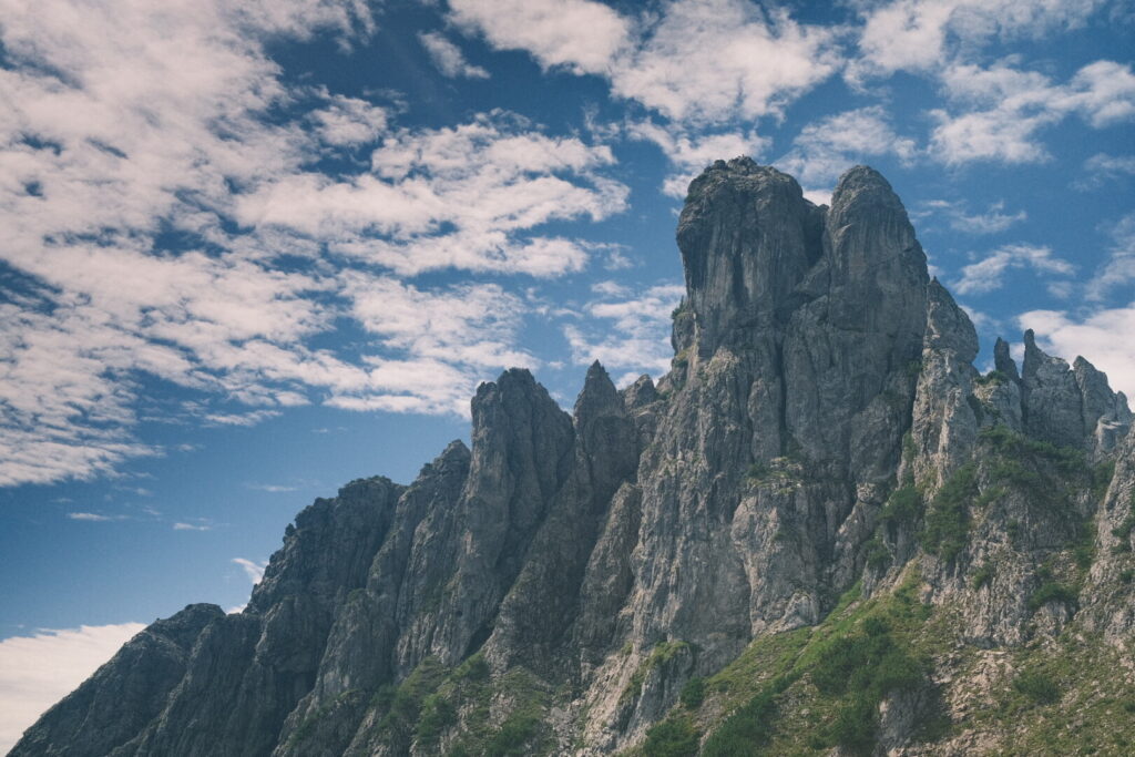
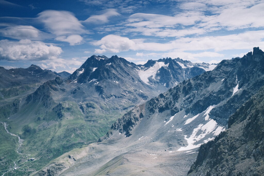
Today a challenging and long walking day is awaiting me on the Liechtensteiner Panoramaweg with alpine characteristics through the Drei Schwestern mountains and the Fürstensteig voted by many as one of the most beautiful stages on the red Via Alpina. And finally I will pass the magic number of 1000km on the Via Alpina. When leaving the Feldkircher Hütte high clouds are covering the sky. The first section runs gently uphill towards the Saroja saddle just below the ridge and border line of Austria and Liechtenstein getting closer and closer to the Drei Schwestern peaks. Towards Liechtenstein the view is dominated by the Rheintal valley backdropped by the Alpstein mountains. At the Saroja saddle the trail gets steeper and more alpine. At around 1900 metres I stand directly in front of the Drei Schwestern peaks and from here the trail follows on a narrow path through the rocks secured by steel ropes and providing ladders to overcome vertical ascents.
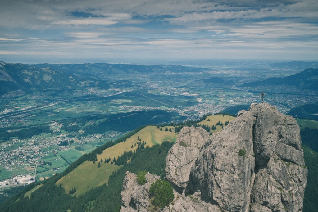
 To the right we can enjoy now a balcony view down to the rhine valley. The secured trail leads up to the third and last of the three peaks providing a complete roundup view to all directions while the view back to the rhine valley over the Drei Schwestern ridge steals the show.
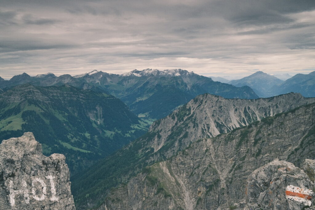
 Ahead the trail continues towards the Garsellikopf peak where we enter Liechtenstein and enjoy splendid views of the whole Rätikon mountain range.
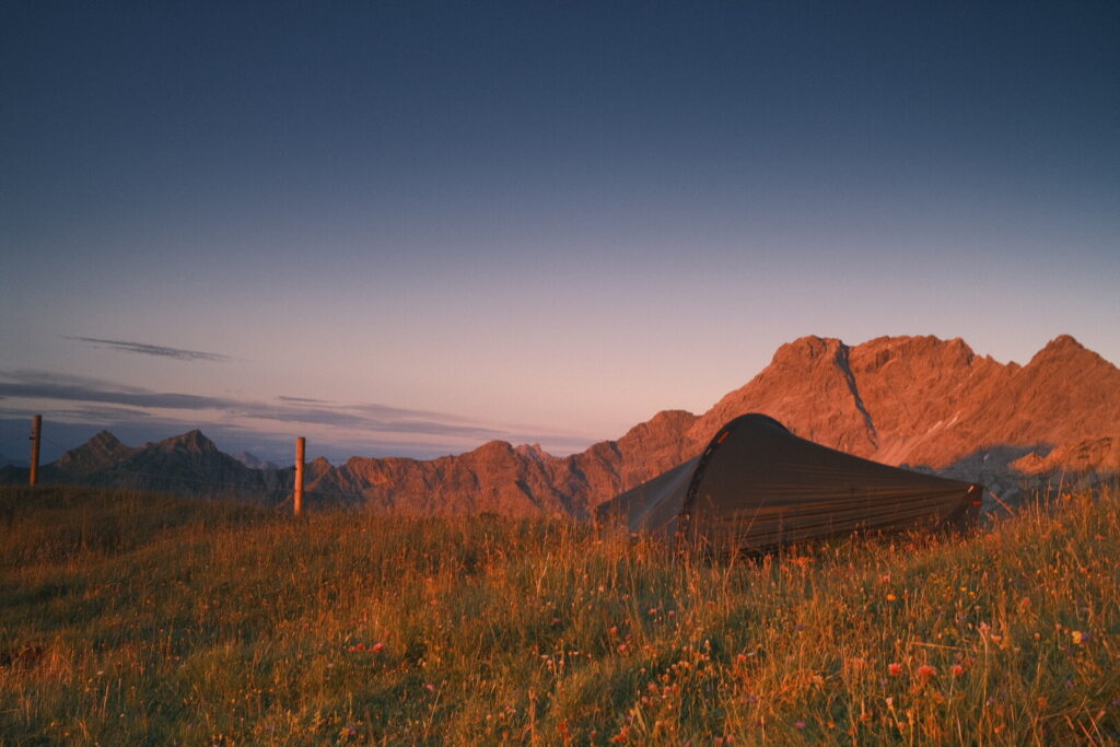
 Moving forward the last and highest peak called Kuhgrat is approached meanwhile on less rocky terrain. From here we descend down towards the infamous Fürstensteig which surrounds the mountain on dramatic turns on loose ground high above Vaduz. It’s clearly visible many rocks falling down here and highly advisable to wear a helmet for this section if you haven’t done so already for the Drei Schwestern leg. After completing the Fürstensteig we descend into the wild Samina valley walking along it’s western slope. After the Steg reservoir the valley continues along the Valüna stream. Its a long walk above the valley until the path crosses the stream to approach the last ascent up to the Bettlerjoch through grasslands populated by cows. In the meantime the clouds have dissolved and the sun is warming up the ground. Arriving at the saddle after having ascended over 2000 metres on this day I am quite exhausted and the sun will set pretty soon and I gain some more altitude to get some distance from the Pfälzer mountain hut built directly on the Bettlerjoch just on the Liechtenstein side of the border and tomorrow we will enter the Austrian state Vorarlberg again. While I pitch my tent on a grassy hill the Rätikon mountains are painted orange and I fall down into the grass to enjoy this magic moment and soak the last warmth from the sun for today.
Day 3: Bettlerjoch-Carschina Hütte
| Distance | Up | Down | Time |
|---|---|---|---|
| 26.5km | +1050m | -950m | 7.15h |
Early in the morning I start my walk surrounding the Naafkopf mountain where the border between Austria, Liechtenstein and Switzerland meets. The trail runs through alpine landscape going up smoothly until arriving at the Hochjoch Gross Furka where a wide view into Switzerland opens up with the vertical walls of the Rätikon appearring behind the Schesaplana mountain the highest peak of the Rätikon range and in far distance a endless amount of Rhaetian Alps peaks reaching up to the clouds. 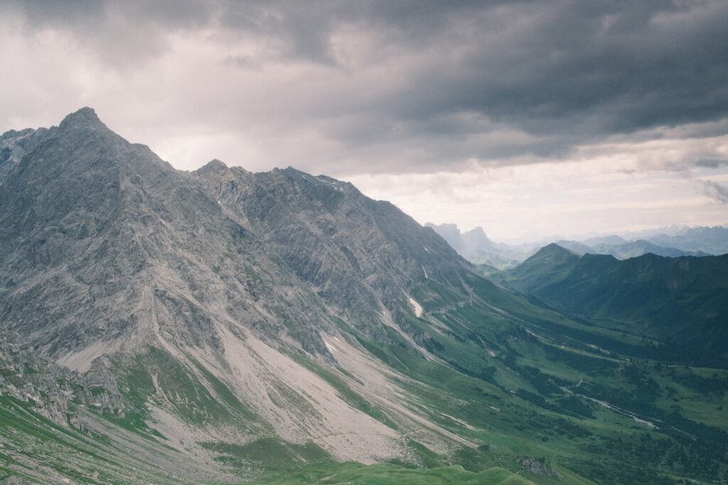 Above me the sky has cleared up and the sun lightens up the meadows down in the valley. I follow the trail down into Switzerland and the Prättigau area. Pretty soon I arrive at the Schesaplana mountain hut where I stop for a short rest. The trail continues on the popular Prättigauer Höhenweg walking below the Schesaplana mountain whose peak is still 2000 metres above my head. In the distance behind the end of a valley the vertical walls of the Kirchlispitzen and Drusenfluh are already towering up. Arriving at the end of the valley I reach the Golrosa saddle from where we could climb up further up a ridge bringing the Lünersee into the view.
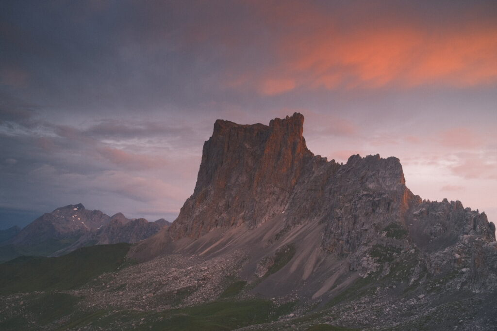
 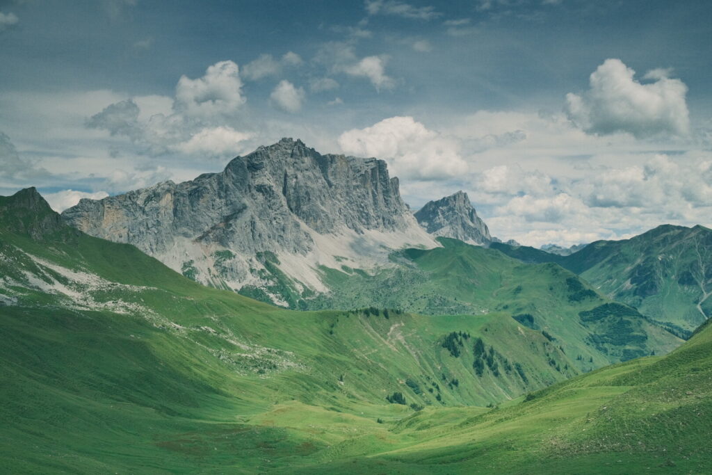 Instead I follow the lower trail below the Kirchlispitzen group towards the Drusenfluh a truly impressive mountain with vertical walls and towers. While approaching and walking below these massive walls the clouds on the sky get darker bringing first light showers. In the far distance I can already identify the Carschina mountain hut but still a 30 minutes walk in the rain away. Luckily the rain is not too intense yet and the thunderstorm is still to arrive after I reach the mountain hut. One more time I am the last one to enter the doors of a mountain hut and the tables are already fully occupied as diner is being served. The crew on the Carschina hut does a great job to give me the warmest welcome and make me feel home. Even tough the hut is fully booked the atmosphere feels pleasant and everything seems fairly well organised. The hut itself is situated on a incredibly beautiful location between Drusenfluh and Sulzfluh. Its a truly impressive mountain landscape at the furthest remote corner of Switzerland where I will return in another opportunity and today’s stage is one of my favourite ones on the red Via Alpina.
Day 4: Carschina Hütte-Gargellen
| Distance | Up | Down | Time |
|---|---|---|---|
| 14km | +750m | -1550m | 4.30h |
After the long and demanding hikes the previous two days today will bring a shorter walk which will end down in the valley leaving behind the wonderful Prättigau and jump into Austria one more time. Moreover some rainy weather is announced pretty early in the day and I prefer to avoid a 1000m descent on wet underground or even a thunderstorm on the ridge. Therefore I descend down from the Carschina hut below the Sulzfluh to Partnun pretty soon. From here I plan to ascend along the Wiss Platte & Schijenfluh towards the Riedkopf peak. The official Via Alpina route goes down to St. Antönien instead and climbs over the ridge further south resulting in more altitude difference, longer distance and a less scenic view. The panorama from the Riedkopf peak on an altitude over 2500 metres towards the Prättigau mountains is indeed breathtaking and I highly recommend this shortcut to other Via Alpina hikers. 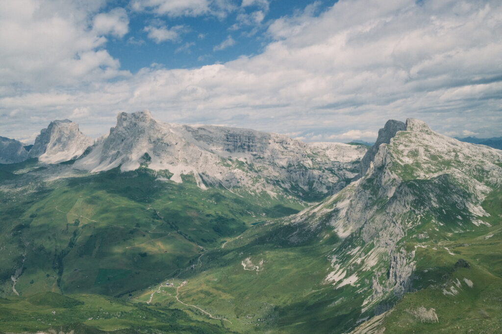 The descend from the ridge into the Gargellen valley again offers beautiful views to the Silvretta group eastwards and the Lechquellen mountains towards the north thanks to the more stable weather than predicted by the weather models.
 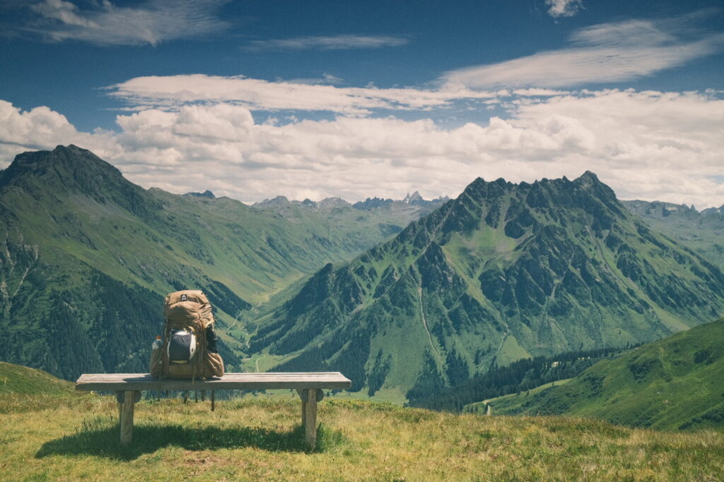 Nevertheless some rainy weather accompanies me on the last kilometres into the Montafon and the town Gargellen. Being Saturday the first two affordable hotels are completely booked but I manage to snatch a room on the third and probably last reasonably prized place in town. Gargellen is the highest mountain village in the Montafon at around 1400 metres and more touristic than I expected.
Day 5: Gargellen-Silvretta reservoir
| Distance | Up | Down | Time |
|---|---|---|---|
| 24km | +1850m | -1050m | 7.45h |
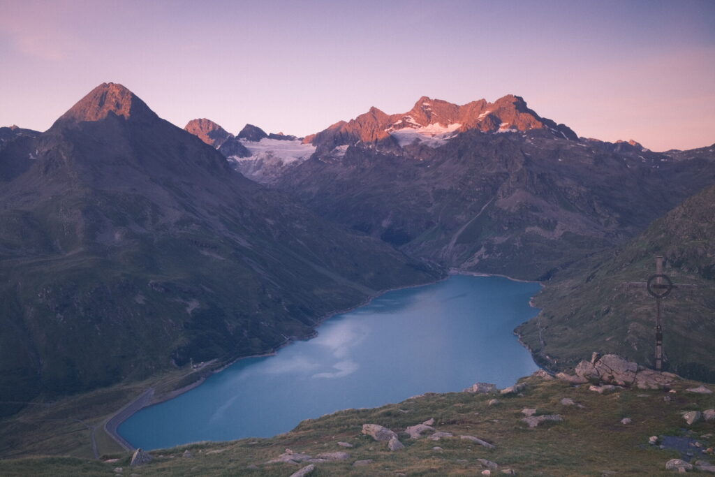
The Haus Wulfenia suprised me with a wonderful breakfast stacked with a wide variety of choices and a really warm welcome by the owners who I missed to run into the day before. They offered me a generous discount and try to support long distance hikers by any means possible so seriously go directly to this place if you stop in Gargellen for the night on your way through the Montafon. After the empowering pit stop at Gargellen the Via Alpina leads me today directly into the heart of the Silvretta mountains. The trail runs smoothly uphill through the Vergalden valley most of the time on a gravel road next to the Vergalden stream. The weather forecast has announced a partly rainy day and a dense cover of clouds fills the sky while fog raises from the valley. After one hour I arrive at the alpine pasture Vergalden Alm where I drink something but the rather harsh wind is not too inviting to stretch out my legs for a longer rest. Not long after I continue my walk through the valley rain starts to fall down and dense fog surrounds me now. After around one more hour the rain stops again and the walking road turns now into a walking trail and starts to ascend steeper on its final leg to the Vergaldner Joch saddle. The fog makes it impossible to catch a first closer glimpse into the Silvretta mountains so I move on to the close by Mittelbergjoch saddle located above the upper Garnera valley and for some seconds the fog dissolves and the Tübinger mountain hut appears on the other side of the valley. The trail descends now traversing the valley and rain is falling down again which makes passing over the big rock fields now quite slippery a challenging task. Completely soaked I finally arrive at the Tübinger hut run by the German Alpine Club. The perfect place to eat something and dry my met clothes in their drying room. During this break the rain stops and leaving behind the alpine hut the fog starts to dissolve and surrounding mountains get visible and some blue sky, too. The last ascent of today up to the Hochmadererjoch saddle just lies ahead. A short but steep scramble through loose rocks runs up to a gateway from where the Vermunt and Silvretta reservoirs appear further down. The last long stretch down towards the Vermunt reservoir takes much more time than expected as the “trail” runs through streams or wet grounds most of the time and the onward trail to the Silvretta reservoir presents itself in a similar poor condition unexpectedly resulting in today’s most challenging section. The Madlenerhaus just below the dam is packed with people already terminating their lunch so I move forward to find a wild camping spot. I object the mountain just behind the Silvretta reservoir. Just behind the Hochalpenstrasse you can get up to the small church to fill up your water bottle on a fountain and continue a short climb towards the Bielerkopf. After a 200 metres climb you arrive at a smaller flat area where I pitch my tent. There is a smallish water stream coming out of the ground in case you arrive here running out of water. Be sure to pitch your tent on the Vorarlberg side of the border not the Tyrolean one. The better campground and views are awaiting you another steep 100 metres climb just below the Bielerkopf but I was just too exhausted of a long day, hungry and a cold night with temperatures tight above the 0 Celsius range are predicted.
Day 6: Silvretta reservoir-Val Tasna
| Distance | Up | Down | Time |
|---|---|---|---|
| 26.5km | +1450m | -2050.m | 9h |
It was indeed a pretty cold night in the tent and I wore some extra layers inside my sleeping bag which reaches its limits on these temperature ranges. The view out of the tent overlooking the Silvretta reservoir and the Silvretta mountains with its glaciars makes you forget about the cold and the sun will reach here pretty soon anyway. Another selling point for this overnight location. Descending down to the Silvretta reservoir the place is already crowded by tourists driving up here by motorized vehicles to observe the year by year shrinking glaciars. I feel like a blind passenger on a sinking ship. After walking a short section on the shore of the lake the walking path continues into a valley before ascending to a plateau towards the Gletschnerscharte saddle which is visible in the far distance already. Turning around a beautiful mountain landscape defines the horizon with the blue shining Silvretta reservoir getting smaller and smaller. 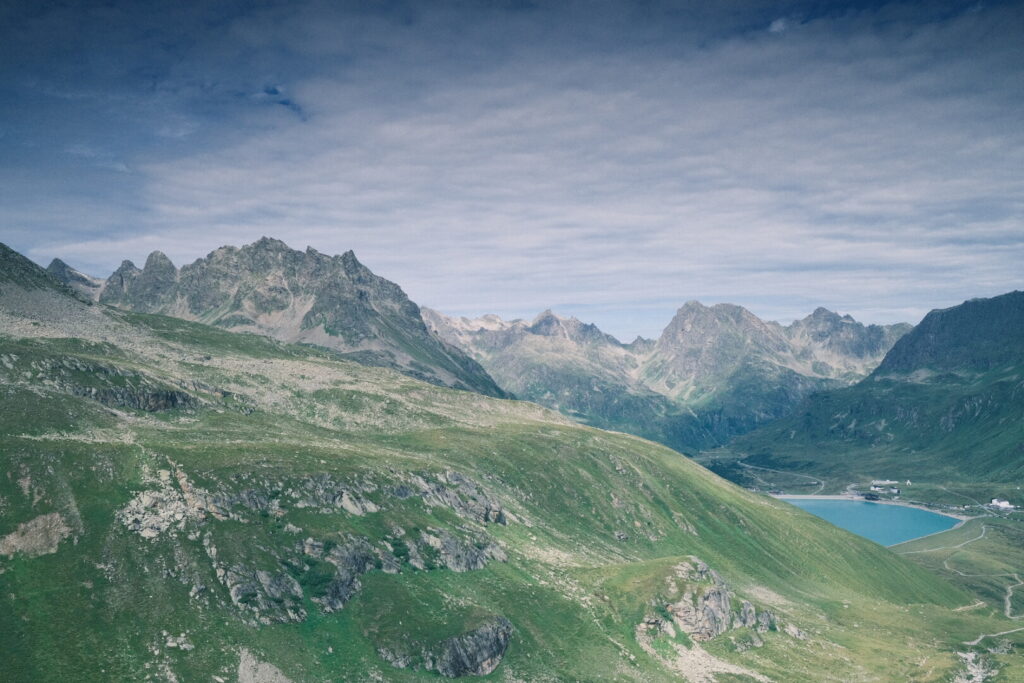 Ahead lies a steep and demanding climb with a lot of rocks and loose ground involving quite some scrambling. The efforts to reach up to the Gletschnerscharte on an altitude of nearly 2850 metres above sea level are totally worth it and rewarded by outstanding views no matter which directions you are looking to.
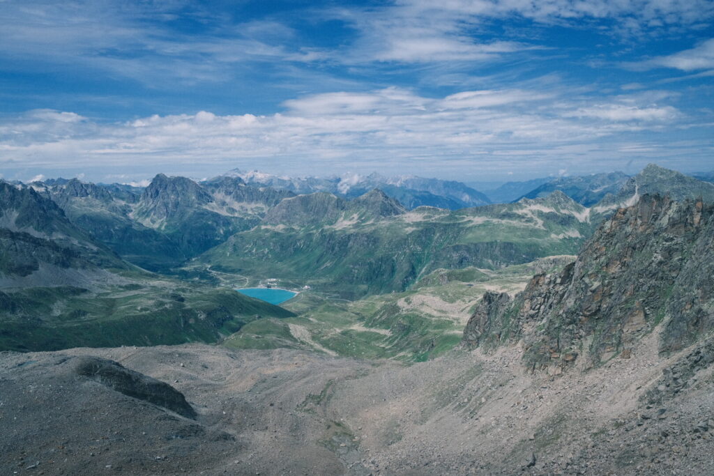
 The name giving glaciars around the saddle are gone already. Looking forward the Jamtal valley and above it mountains below dynamic clouds and hanging glaciers draw a picture of what lays ahead. Climbing down into the valley puts a high difficulty score on this section and makes it absolutely an alpine trail which should only be approached under stable weather conditions and with required experience and adequate equipment. Personally I would rate this downhill section among the most demanding ones so far along the official Via Alpina route so take your time here and watch your ground. Descending with caution you are welcomed by wide views into the beautiful Jamtal valley and more big glaciers appear when looking up in different side valleys.
 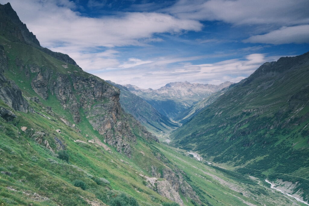 Its already 4 o’clock when I arrive at the Jamtal mountain hut and it seems already too late to make it over another mountain pass into Switzerland. So I try to check-in for a dormitory bed. As it turns out this tasks cannot performed by normal employees so I need to wait for “the boss”. After 30 minutes she arrives and we are supposed to go through the usual process. As I learn pretty soon it is not allowed to stay at this house with a normal sleeping back only the liners (aka hut sleeping bags) are approved. So I need to wait as she has to check with “the boss”. Another 30 minutes later the man of the house teaches me in a disrespectful manner I cannot stay for the night and throws me literally out. As it turns out they had an hygienic incident some years ago and where fined seriously. Obviously the fear this might occur again they follow a policy of zero flexibility putting financial interests above one of the core tasks of mountain huts which is providing shelter to mountaineers and sending people away at 5PM is in many senses non responsible. As he tried to sell me they are a professional mountain hut and this is common behaviour in the Silvretta area. Talking to other huts run by the DAV (including neighbouring ones) and guests staying at this place the previous night are raising doubts regarding how the hygienic topics are handled and professionalism in general (unfriendly crew, average food, missing atmosphere). I would have rented or bought a one-time hut sleeping bag like it is common in other alpine huts which rather act professional than label themselves. If you plan to stay at this place keep this negative experience in mind and even tough I had best feelings staying on huts owned by the German Alpine Club in the Wetterstein & Allgäu ranges the Jamtalhütte and such behaviour should not be encouraged. After this unpleasant loss of one hour I had no other choice than head off to the Futschöl pass where I planned to arrive in another two hours. Things presented themselves more complicated as a huge rockfall at the Fluchthorn has recently blocked the original trail and a new one has been unofficially born on the other side of the Futschölbach stream which is not signposted and you must find a way to cross the stream to rejoin the original trail (GPS is helpful here). From the Jamtalhütte follow the trail to the Pfannknecht peak on the right side of the Futschölbach until an altitude of 2340 metres then follow a cow gate and walk along the path up a big hill of stones then following the stream up to the point on 2470 metres where the stream flattens and is weak enough you can easily walk over the bigger stones and rejoin the official trail just above the waymark on 2476 metres close to the shelter. From here it is a really easy and gentle uphill walk with almost no incline until crossing again from Austria into Switzerland and this time saying definitively goodbye to (Northern) Tyrol. The descent from the Futschöl pass follows an easy walking path through loose rocks until turning into the remote and beautiful upper Tasna valley walking on grassy underground.
 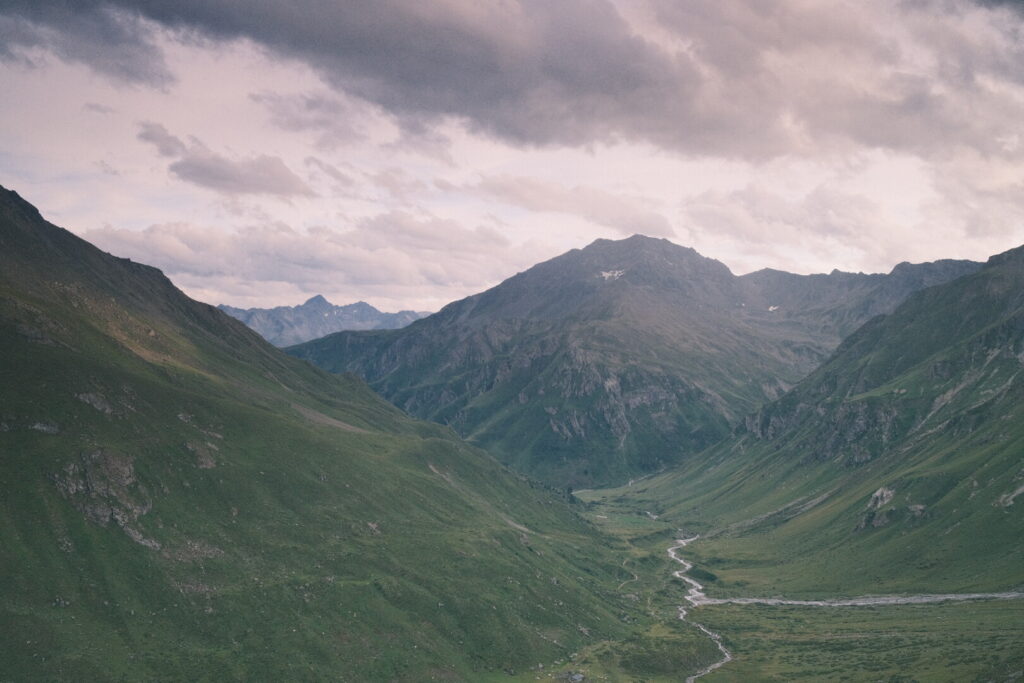 After descending to the valley floor you follow the valley next to the wild Tasnan river with views of the massive peaks towering high above the Lower Engadine valley.
 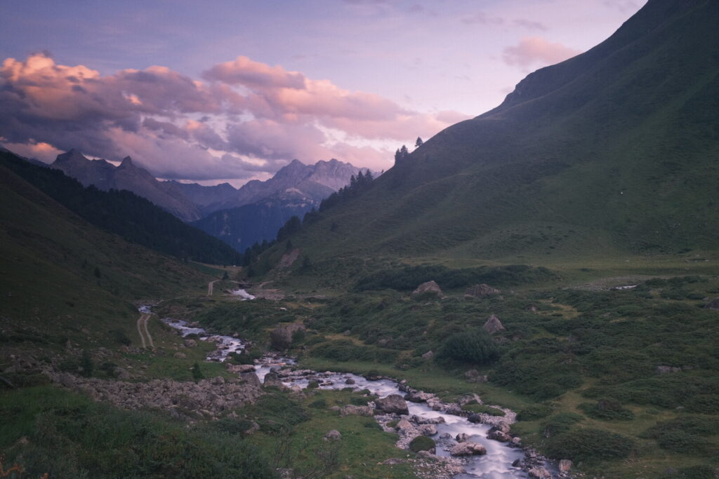 After walking for many kilometres trough the Tasna valley and approaching its lower end I pitch my tent at a barbecue place with picnic table already in complete darkness.
Day 7: Val Tasna-Scuol
| Distance | Up | Down | Time |
|---|---|---|---|
| 7.5km | +100m | -400m | 1.5h |
Since a week this Tuesday was announced to be a wet one for big parts of Europe and the Alps. Thanks to the long walk of 9h yesterday I am only 8 kilometres away from Scuol and I should manage to arrive there before the serious rain cells are here. It is first of August when people decorate their houses with nation flags and blindly celebrate the existence of our own failing nation state. It wasn’t necessary to walk through the Alps and crossing all these places of wars and conflicts which led to modern nation and language borders to understand its time to abolish nationalism and borders. That’s what we should talk about this day and not burning toxic firework and resources for a concept with no future. Well at least the last point got ruled out by climate change and a law in the canton of Graubünden prohibiting burning firework. Thanks to another law in this very same Canton with which capitalistic interests overthrow public holidays even in the small hamlet of Ftan grocery stores or bakeries are open today and all Sundays during the year. I admit I also walked into heaven like a lamb to the butcher. After this second round breakfast I walked high above the Lower Engadine valley viewing down to the valley floor and the Inn river and the Dolomites of the Engadine high above the valley.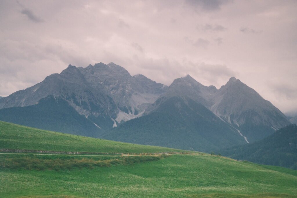 It starts to rain. First weak but with increasing intensity the closer I get to Scuol. Luckily I arrive at the Youth Hostel early in the day because it will be a rainy day until the evening.