Day 1: Thörl Maglern-Feistritzer Alm
| Distance | Up | Down | Time |
|---|---|---|---|
| 18.5km | +1800m | -750m | 6.45h |
The first morning in Austria starts with a near to perfect breakfast buffet with everything you can imagine and a wide variety of healthy choices, too. Manuela the owner of the Pension Galle puts a lot of heart and soul in this place and its obvious every detail is well thought to the end here. The perfect place before a strenuous day into the carnic alps and the opening of the Karnischer Höhenweg. The approx 110km long Karnischer Höhenweg (“Peace Trail“) was created after 1974 from a trail system built in World War One, which was used by Austrian mountain troops for supply purposes. It runs along the carnic alps and was the front line of a brutal mountainous battle during WWI between 1915 and 1918. The whole stretch is spotted with remainders from these dark times like bunkers and trenches and serves as memorial against all wars and nationalism.
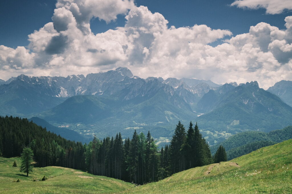
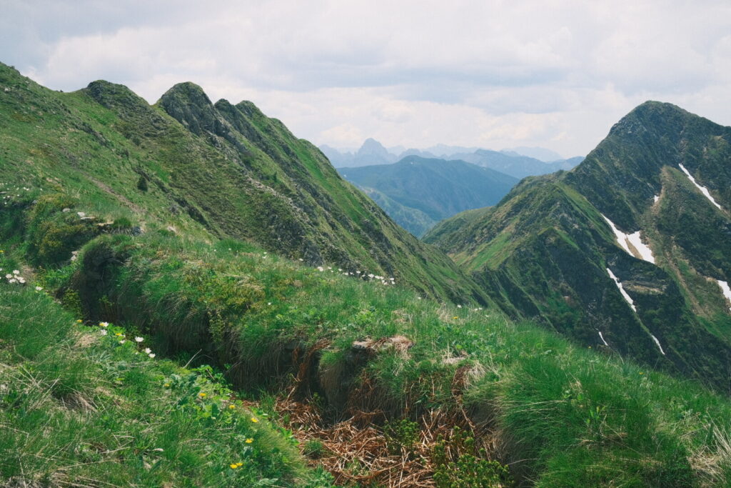
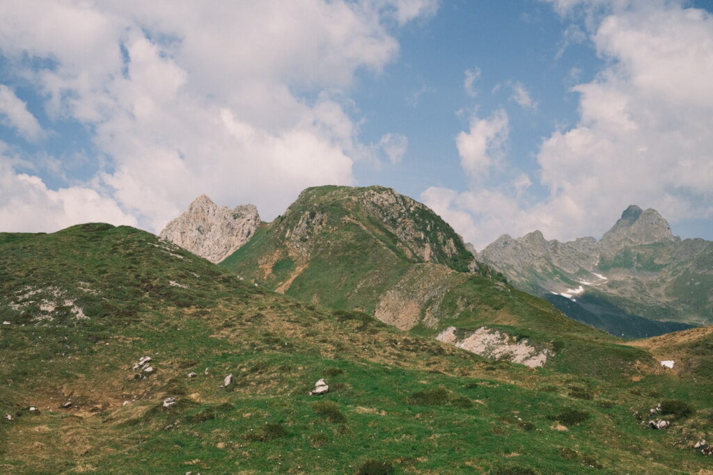
The first stretch after leaving back Thörl gets into forests soon and the path climbs steeply uphill to reach the Göriacher Alm situated 1000m above. After a tiring walk and leaving the forrests a wide meadow spreads a spray of summer. The Julian Alps dominate the background scenery.
 The warming sun and the silence invite to sit down and enjoy the peaceful mood while the horses are strolling around. The walk continues rather flat and then downhill to the Bartolosattel. From here its another 500m steep uphill climb to the Achomitzer Alm and in short distance the Feistritzer Alm. Which was once a well established wooden walking path is now cowland or uprooting area with fallen trees and close to non existing trails which makes coming through extremely hard and exhausting. After almost 7 hours and climbing up 1800 meters my body has touched some limits for the first time on the Via Alpina. On the Feistritzer Alm I am spending the night in a quite basic and chaotic mountain hut run by Martina a very welcoming and charming host and some tasty italian cuisine.
Day 2: Feistritzer Alm-Egger Alm
| Distance | Up | Down | Time |
|---|---|---|---|
| 16km | +650m | -950m | 4.15h |
The Feistritzer Alm and the surrounding meadows and hills are covered in fog turning this morning into a mystic atmosphere. Today awaits me a quiet relaxing and easy walk through woodlands and pastures. The first stretch surrounds the Oisternig mountain on italian soil and descends into the Lomsattel. From here the path climbs up through dense forest up to the Starhand mountain the highest point so far in the carnic alps. It follows another descent into a valley where Sven from Winterthur is closing up to me out of the nowhere. He had started early in the morning from Thörl-Maglern and made all the way up in a single day. We continue together uphill to a high plateau on around 1500m where we walk through the Dellacher Alm and arrive one hour later at the Egger Alm. We finish the day at Rudi’s Skihütte where we meet a girl from Freiburg who started today her Karnischer Höhenweg hike and we might probably meet her again in the carnic alps.
Day 3: Egger Alm-Rudnik Sattel
| Distance | Up | Down | Time |
|---|---|---|---|
| 19km | +1250m | -750m | 5.15h |
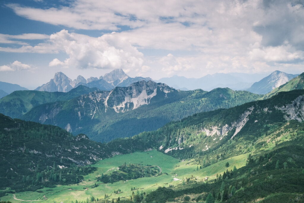
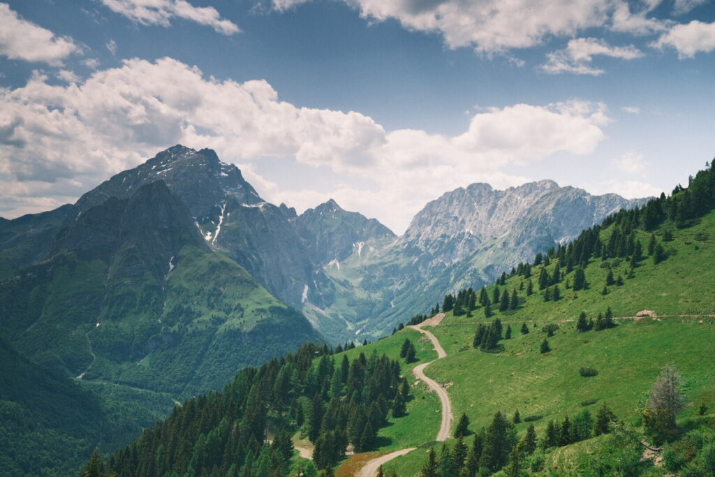
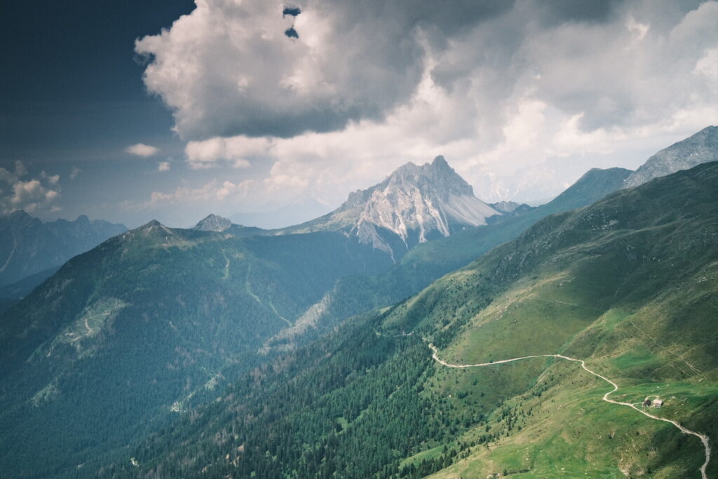
Another foggy morning in the Carnic Alps. Henni from Freiburg will join us today for the walk towards the Nassfeld Ski resort. She arrived yesterday on the Egger Alm to start the Carnic Highway. From the Egger Alm we ascend smoothly uphill to the Stallensattel where we enter Italian ground. The path gets more alpine now when we surround the Zielkofel on its southern side before we return to Austria to climb up to Garnitzerberg. The landscape here is destroyed by infrastructure of the skiing area Nassfeld. The mountains are covered in clouds and rain starts to drop down on the final ascent to Nassfeld. Henni will stay here for the night and Sven and myself continue our walk for some more kilometres until the Bivacco Ernesto Lomasti located just below the Rudnik Sattel. The first section climbs uphill through ski slopes to the Madritschen Mountain. From here we walk down a small valley and enter a last climb up to the Rudnik Sattel and leave behind the unpleasant scenery of the Nassfeld mass tourism area. Just below the Rudnik Sattel on the Italian side a small Bivacco of the italian alpine club is perched overlooking a beautiful valley with fantastic mountain views.
Day 4: Rudnik Sattel-Zollnerseehütte
| Distance | Up | Down | Time |
|---|---|---|---|
| 18km | +750m | -900m | 5h |
vEarly in the morning before the walls of the Trogkofel are painted by the first sun light I get out of the Bivacco and dive into the cold and silent morning world. Not much time later I squeeze myself back into my sleeping bag. Around 10 o’clock Henni arrives from Nassfeld with some delicious breakfast leftovers from her hotel. Great move! Soon the three of us move on walking first surrounding the massive walls of the Trogkofel. The path is pretty alpine already and completely different than the previous days.
The old war-time roads, cliff forts and overgrown trenches from World War 1 are reminders of the disputes over the border area. The trail continues trough the Rattendorfer and Kordin Sattel downhill towards the Straniger Alm where we stop for a refresh before the final ascent. On the final part we walk along the Zollnersee before arriving at the Zollnersee alpine hut our home for the night.
Day 5: Zollnerseehütte-Untere Valentinalm
| Distance | Up | Down | Time |
|---|---|---|---|
| 20km | +1050m | -1550m | 6h |
Today I head out to the trail alone again as the two German girls have reserved at the Wolayersee hut a hefty 9 hours walk away. Sven also walks with them while I take the relaxed schedule. The trail leads across the meadowland of the Obere Bischofalm towards the 2,167m high Köderkopf, from which you can enjoy a wonderful view. The climb is quite pleasant as it smoothly traverses steep slopes. As the path is narrow it could be difficult and dangerous under wet conditions. Only the last uphill section climbs steeply to the top from where the views are incredible. Around the summit you can spot ruins of bunkers and overgrown trenches on both sides.
 The path down runs steeply over alpine grass and traversing again over a narrow path along steep slopes which requires full concentration. After the Obere Spielbodenalm the final descent leads down to the Grünsee and the close by
Plöckenpass.
 From here its not far anymore to the Untere Valentinalm at just 1200m right below vertical limestone walls towering high above the Valentin valley. Here Birgit and Andreas run the Almgasthof Valentinalm offering a small but regional and fresh selection of Kärntner dishes with herbs from their own garden. Today was the second day in a row without rain and the weather announces another two days of sunny weather.
Day 6: Untere Valentinalm-Wolayersee
| Distance | Up | Down | Time |
|---|---|---|---|
| 7km | +950m | -200m | 2.45h |
After a cosy night in the rustical and charming dormitory of the Almgasthof Valentinalm I enjoy a rich breakfast with freshly prepared ingredients. The perfect treatment to be ready for the trail. Today a rather short walk allows to use the second half of the day to relax and recover. The trail runs smoothly uphill through the forest to the Obere Valentinalm. Butterflies are everywhere around the blooming flowers and in the distance marmots are tolling around.
The path continues over alpine grasslands towards the Valentintörl just below the high walls of the mountain Hohe Warte which has been dominating the horizon yesterday since arriving at the Köderkopf summit. The Valentinörl opens the view into a new world with the Wolayersee already visible at the bottom.
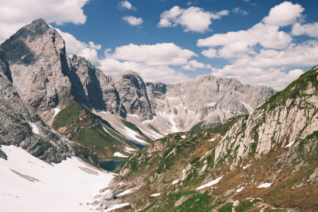
A large snowfield allows to walk and slide down towards the lake where many people already stroll around the lake or have a short swim. At the northern end of the lake a mountain hut welcomes hungry hikers on this sunny saturday. I spend the afternoon doing just nothing. In the evening I will walk up the Rauchkofel summit at almost 2500 meters to enjoy the sunset in the altitude and breathe some alpine air.
Day 7: Wolayersee-Luggauer Törl
| Distance | Up | Down | Time |
|---|---|---|---|
| 19.5km | +1400m | -1150m | 7h |
From the Wolayersee the trail descends to the Obere Wolayer Alm and crosses along the valley before climbing up shortly but steeply to the Giramondo pass through alpine meadowlands.
 Here we cross into Italian territory passing lake Pera and descending further down into the Fleons valley. The trail continues uphill along the valley until the Ofner Joch where we return to the austrian side. A short walk away lies the Hochweisssteinhaus hut where I stumble into the other Carnic Highway walkers. After a short break and some reflections I decide to continue my walk for some more kilometres as the walk of the next day will be for a large distance trough high alpine ground and thunderstorms are announced already in the afternoon. This way I can shorten the queen stage of the carnic highway a little bit. The trail crosses steep slopes gaining altitude and already from the distance I can spot quite large snowfields. In the end I need to cross 5 snowfields without crampons, ice axe or walking sticks in steep ground. For the first time I take some serious risks and bundle all my concentration as every step could have serious consequences. Somehow I manage to get through these obstacles but it costs me a lot of energy.
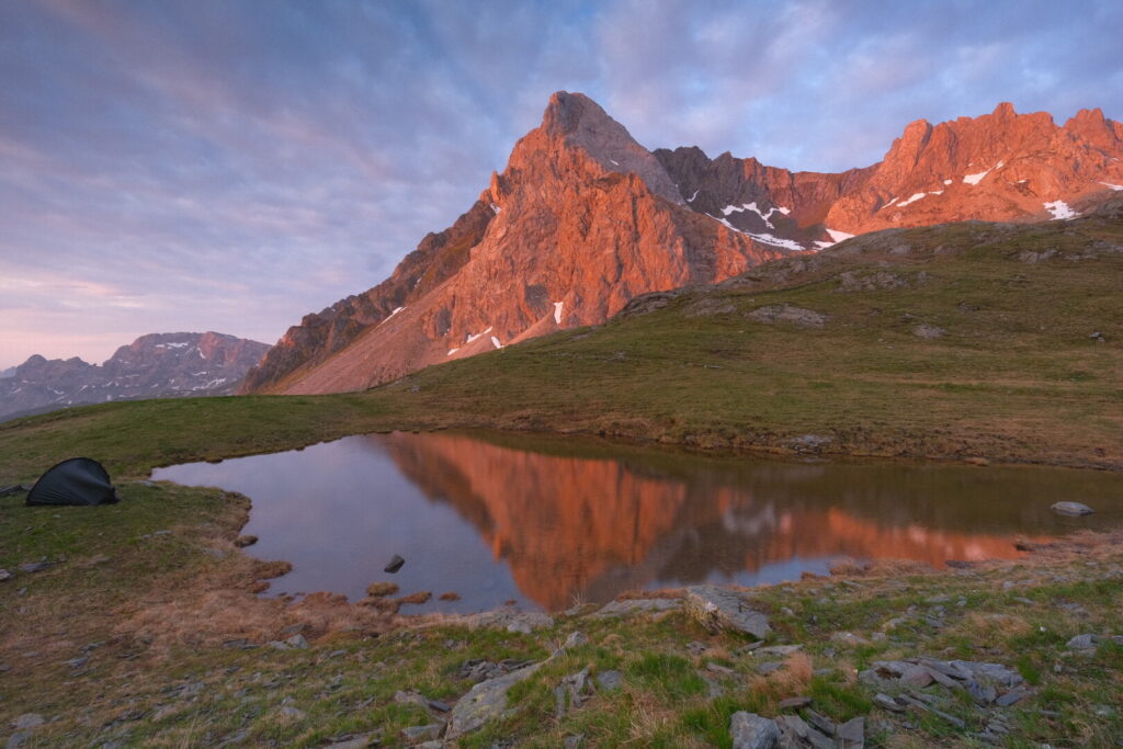
After this critical section the path continues uphill to a plateau with a small pond just below the Torkarspitz where I planned to pitch my tent for the night. On the way up I cross a local farmer who is bringing down a sheep which was hurt by wolves. He asks me where I am heading to and we have a short talk about wolves. He asks me if I were not scared and tells me he himself would not sleep up there in the mountains as this is wolves territory and people in the valley seem to believe its just a matter if time until they attack humans, too. Arriving at the pond I pitch my tent and prepare a meal. Strong winds are sweeping through and the fog creates a mystic and raw atmosphere and I already draw an image where wolves walk out of the fog down from the slopes. If I haven’t felt connected to nature before now I did for sure. The night falls and I hole up myself into my cosy sleeping bag.
Day 8: Luggauer Törl-Porzehütte
| Distance | Up | Down | Time |
|---|---|---|---|
| 15km | +900m | -1150m | 5.45h |
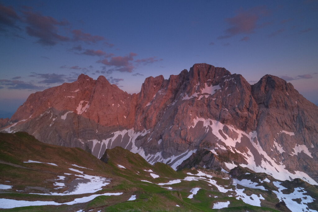
bStrong winds pushed against the walls of my tent and kept me awake until midnight. When I awoke at twilight time the sky above was clear and the wind has almost disappeared. The first sun rays paint incredible colours on the walls of the Torkarspitz reflecting in the small pond few meters away from my tent. These are the moments that make the essence of sleeping high above the valley.
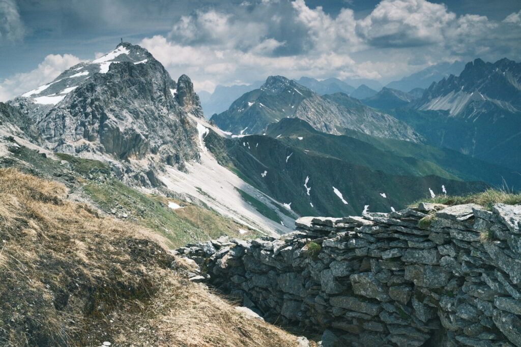
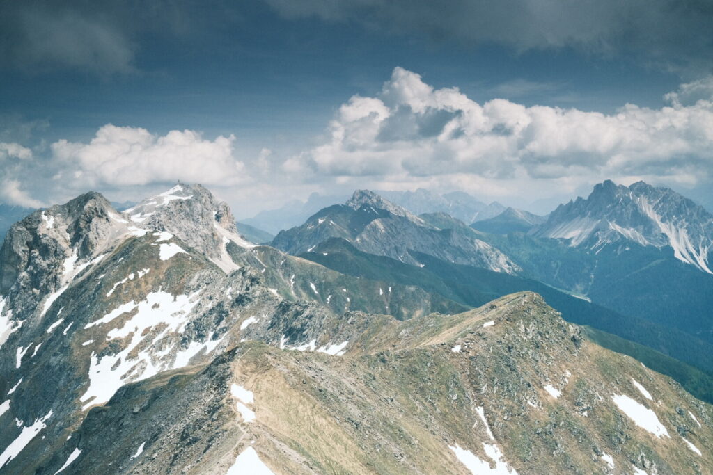
 I need some time to get my things ready but at 7 o’clock a new walking day can be started. Its not less than the queen stage of the carnic highway running along mountain ridges on alpine underground for almost 15km. First I ascent up to the Luggauer Sattel on an altitude of 2400m from where a narrow trail winds just below the ridge line towards the Steinkarspitz mountain summit over 2500m. From the ridge line viewing towards Italy we can already enjoy an umpressive panorama of the eastern Dolomites with its vertical limestone walls. The path continues up and down towards Hochspitz the next mountain along the way. Here the trail winds down extremely steep making it probably the most difficult part. After this section it gets easier and the trail surrounds the Gamskofel arriving at the Gamsscharte on around 2200m. From here we climb ug again to the Reiterkarspitze mountain.
 In the meantime dark clouds are visible on the sky above the mountains and the announced thunderstorm seems hitting in earlier than scheduled which lets arise some sorrows as I am still in high altitude and the final ascent to the Bärenbadegg is still to come. I try to be be fast but cannot hide the exhausting walk so far. Meanwhile thunder is growling directly above me and blizzards going down short before the summit accompanied by rain which changes into hail after the summit making the experience even worse. The steep path down the mountain out of the danger zone is now a huge system of small streams of rain water flowing from everywhere towards the valley. I am completely soaked and its still a long descent to the Porzehütte and I am relieved when at least the rain stops for the last kilometre. Its around 2PM when I finally arrive at the mountain hut where I get out of the wet clothes and shoes.
Day 9: Porzehütte-Obstanserseehütte
| Distance | Up | Down | Time |
|---|---|---|---|
| 12km | +1100m | -700m | 5h |
Under the warm morning sun I follow a pleasant uphill path under the walls of the Porze mountain up to the Porzescharte where we enter into a high plateau which provides great views into the greenish Filmoor. The trail follows along the plateau until Heretriegel where we descend to the idyllic Oberen Stuckensee an inviting place to sit down and enjoy the silence. Directly a short but steep climb goes up to the tiny Standschutzenhütte which was built on top of war ruins and backdropped by the Königswand. After a short break and a delicious refill I climb further up along the Königswand towards the Grosse Kinigat. The path runs now on an altitude of around 2500m up and down surrounding the high walls and continuing towards the Klein Kinigat where overgrown trenches and ruins remember to the World War 1 and its merciless frontline in these high altitudes.
 The path continues on the ridge line up to the summit of the Pfannspitze offering views in all directions from an altitude of 2678 metres above sea level the highest point so far on the Via Alpina.
 On the way down to the Obstanser lake with ice swimming on its surface I slide down a large snowfield to finish another alpine stage in the carnic alps. Tomorrow I plan to head down into Italy and make my way into the mighty Dolomites.