Day 1: Pragser Wildsee-St. Martin in Gsies
| Distance | Up | Down | Time |
|---|---|---|---|
| 23.5km | +350m | -550m | 4.30h |
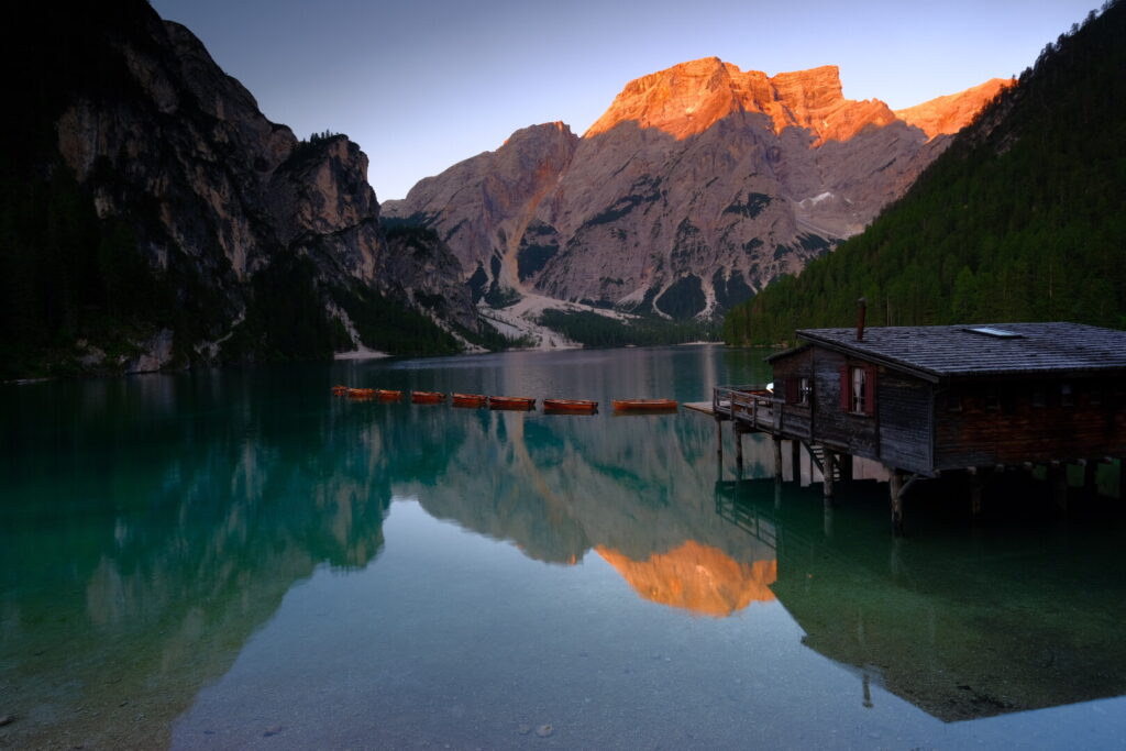
Today a long but flat valley walk defines the day and I expect a rather boring walk under the burning sun. The first section runs downhill along the Braies river through the forest of the Braies valley into the small town of Schmieden where a small grocery store supplies my breakfast: olive bread with lupine hummus and fresh raspberries & blueberries. The heavily missed vegan morning retreat on such a journey! The walk continues after a short climb and softly descending towards Welsberg a bigger touristic town in the Puster valley. The Val Pusteria / Pustertal is considered to be one of the most beautiful valleys in South Tyrol and one of the largest & longest in the alps. The walk to Welsberg runs on the bicycle trail and many holiday makers enjoy a ride on this sunny monday. It seems now a major touristic activity to rent e-bikes even for the flattest trails and traditional bikes are quite exotic and difficult to spot. Its been exactly 15 days since my last supermarket visit and the time has come to refill my backpack with some essentials for the life on the trail. Out of Welsberg the trail continues slightly uphill into the Gsies valley on the Talblickweg again a trail mainly used by cyclists. After 23 kilometres walking through the valley I indulge myself in the luxury of a hotel with wellness area included and great food. Hotel Waldruhe is a great stop for Via Alpina walkers and the staff here is super helpful in any regards and well established for hikers. They even granted me some discount and explained the shortcut for the next stage.
Day 2: St. Martin in Gsies-Antholz Mittertal
| Distance | Up | Down | Time |
|---|---|---|---|
| 20km | +1150m | -1200m | 5.15h |
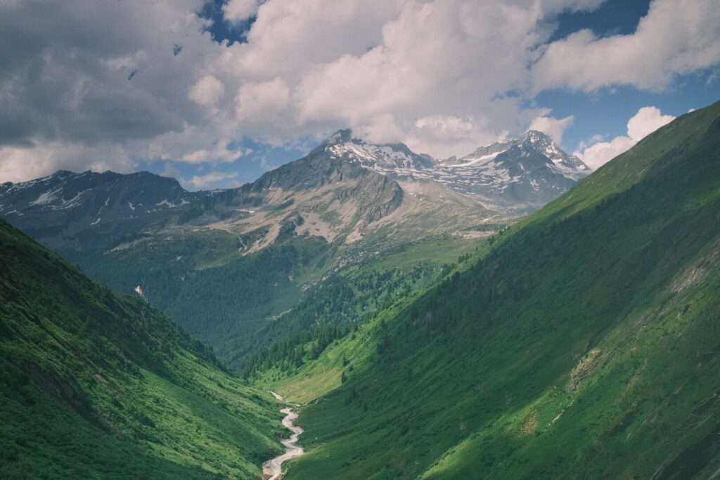
After three days of much sun & heat and few clouds and the first sunburn i a blind spot on my leg I am relieved to encounter a day with a cloudy sky. Today’s walk mission is stupid simple. Climbing up 1100 metres to the Grüblscharte and get down into the Antholz valley before the announced thunderstorm arrives. The uphill walk is quiet pleasant and runs through forests up the Karbach valley following the Karbach stream and in the upper part the Hundsbach stream. After a long walk of 10km on the forest road we arrive the mountain pasture Ochsenfelder Alm where a steeper walking trail climbs up to the Grüblscharte. Walking over the saddle o new mountain range gets into the view: the imposing mountain world of the Rieserferner mountain range with a couple of its 38 three-thousanders visible from up here among them the Hochgall peak the highest one of the range.
 The typical Rieserferner limestone reminds me a lot to the rocks of the mountains in southern Greenland.. The way down is a lot steeper but with a well established serpentine trail the high peaks of the Rieserferner group always defining the view. After walking by the Grüblalm the trail enters woodlands with steep slopes and the last section down into the Antholz valley is pretty steep, too. I planned to pitch my tent on the ground of the camping in the town Antholz-Mittertal but their pricing is at least as steep as the surrounding mountains and their facilities are average at best.
Day 3: Antholz Mittertal-Rieserfernerhütte
| Distance | Up | Down | Time |
|---|---|---|---|
| 8.5km | +1550m | -0m | 3.30h |
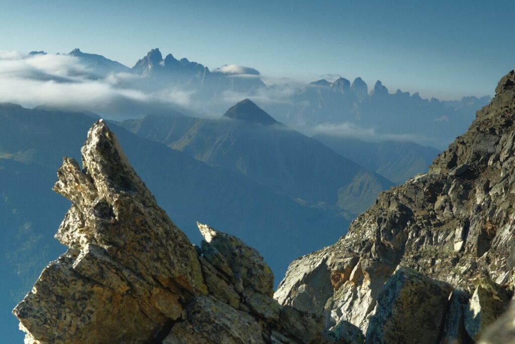
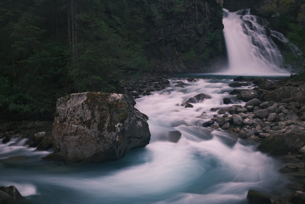
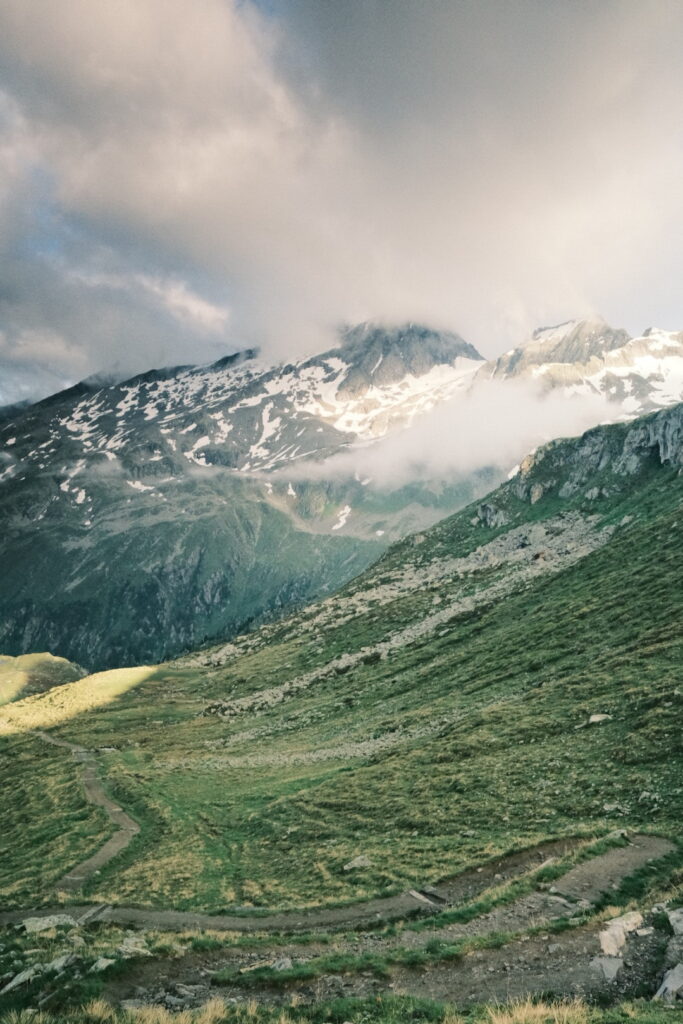
With a distance of only 8km the stretch of today results in probably one of the shortest official stages on the red via alpina but its direct climb of 1550 metres should also be in the upper range. The first kilometres are running mainly on a forest road which also leads to two bigger waterfalls which seem to be a major attraction in the valley as there are many bigger groups on this section. After the impressive Klammbachfall the forest road is soon replaced by a steep walking trail which seems to climb uphill without an end. Gaining height the weather gets more alpine and chilly. On the last 150 metres of altitude difference a massive wooden stairway leads the path through the rocks pushing out the last pieces of energy left from the walkers making their way up here. After the wooden stairway is conquered the Gemsbichljoch pass is finally reached and in short distance lies the Rieserfernerhütte. A massive alpine hut built from stones in a desert of stones with a small lake still partially frozen in short distance. Looking back in the far distance a last glimpse of the Dolomites covered by foggy trails. Up here on an altitude of almost 2800 metres a strong and cold wind lashes over the ground pushing new arrivals directly into the mountain hut and its common area with a much beloved stone oven. It took me roughly 3.5 hours to getting to the hut from the valley and I can enjoy the afternoon recovering from the physical efforts.
There are just two other guests for tonight and each of us gets their private dormitory room. I get the impression of a beautiful, well organised and perfectly equipped mountain hut with a friendly team and delicious food prepared by the kitchen in a rough mountain environment.
Day 4: Rieserfernerhütte-Sand in Taufers
| Distance | Up | Down | Time |
|---|---|---|---|
| 18.5km | +200m | -1950m | 5h |
After two cloudy days and few opportunities to feel some warm sun rays on the skin the night was clear and extra cold. All the snow around the mountain hut is icy and although the wind is almost gone its ice cold until the sun rises and warms up the surfaces. Walking down the mountain in shadow areas with shorts feels still pretty cold especially through the shadowed side of the mountain. Its the longest descent so far and I will go down from 2800 to 900 metres which is a real stress test for my knees and one of the infamous moments you ask yourself why one would do this to itself. The first stretch runs through a long section of stones wherever you look and go and with views to the snow covered mountains on the Durreck group which separates the Rieserferner range from the Zillertaler Alps. Further down a wide and lush green mountain pasture appears and a lot of small streams flowing down the slopes form the Geltal river. The trail now continues through a rocky forest until arriving at the Rein valley where the strong Rein river flows westbound to Taufers where it unites with the Ahr river feeding the Rienz river the main water body flowing through the Puster valley. I decide shortcutting the valley walk which takes a large detour by going straight down the valley mainly along a pass road during 5km with some short tunnels, too. After that not too pleasant section I follow again a hiking path which runs in close distance to the Rein River through a wild gorge and at three places the water masses hit over the rocks as powerful and picturesque waterfalls short before calming down and arriving at the touristic town Sand in Taufers above which towers an impressive castle.
 A lovely place surrounded by mountains, forests and rivers attracting tourists mainly from warmer Italian regions. Even tough I normally run away from touristic hotspots I like this place and as bad weather is suposed to arrive tomorrow I decide to spend a day here and continue my hike after two nights. Above the town I find a room in a family run Bed&Breakfast close to the castle overlooking the wide Tauferer valley until Bruneck and the Kronplatz ski area.
Day 5: Sand in Taufers-Chemnitzer Hütte
| Distance | Up | Down | Time |
|---|---|---|---|
| 17km | +1550m | -100m | 4.30h |
After a relaxing bad weather day at Sand in Taufers and rebuilding my forces I am ready to rejoin the walking trail and enter the Zillertaler Alps. The weather forecast is announcing one week of rather unstable weather so it will be tricky to get through the next days. The official Via Alpina guide advises to take the Speikboden cablecar to cover the 1000m of elevation through the ski area above Taufers. I decide to go a different path and walk up the Ahrn valley avoiding the ski area completely. The first section runs flat along the Ahrn river until another touristic town called Luttach. From here I follow the Weissenbach stream steadily uphill leading through the small settlement Weissenbach and further into the valley. Its a pretty warm day and at these lower altitudes and around midday sweat rivers are flowing down my skin. The walking trail climbs up to two mountain pastures. At the Gögealm I take a rest and enjoy a vegan buckwheat cake and some refreshing to be ready for the last part of the climb which enters now more alpine ground. Short before arriving at the Nevesjoch at 2400m above sea level the sun finally breaks through the dense clouds. After climbing up more than 1500m I am happy to spend the night in the nearby Chemnitzer Hütte. The people working here is really attentive but the atmosphere on the small hut was a little bit too noisy for my personal preference after a exhausting walking day.
Day 6: Chemnitzer Hütte-Brenninger Biwak
| Distance | Up | Down | Time |
|---|---|---|---|
| 15.5km | +850m | -1100m | 7h |
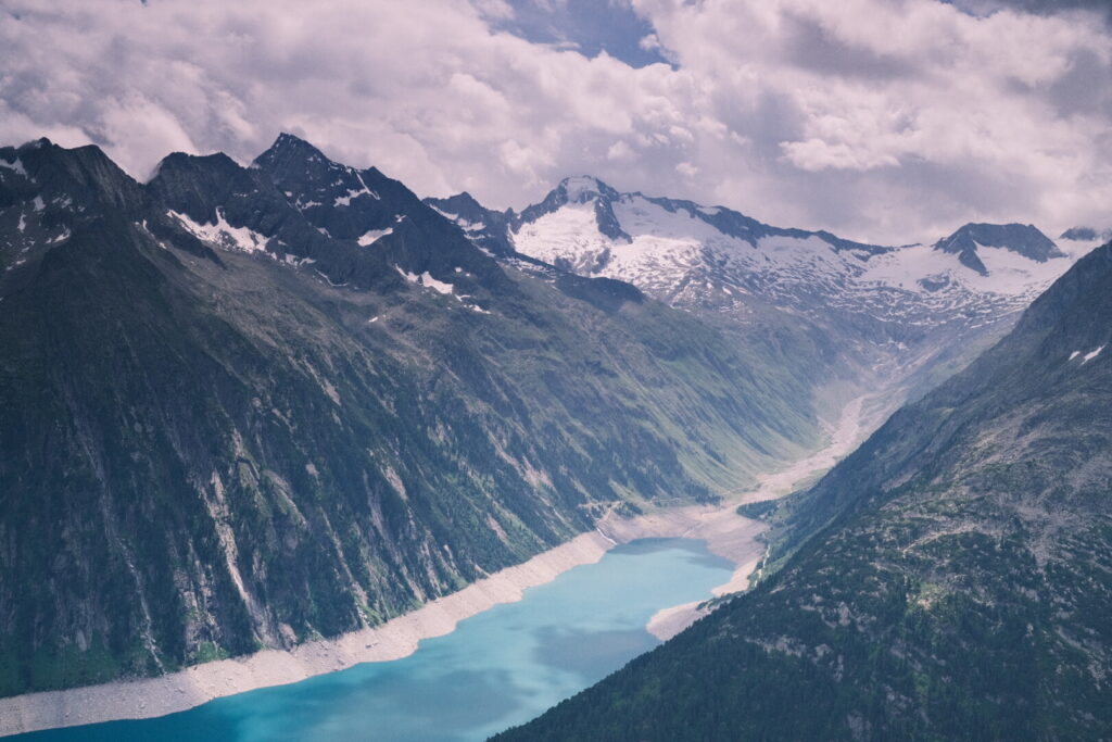
The day starts with fog and clouds covering the mountains of the Zillertal Alps just above and really close. I follow the Neves Höhenweg trail which just surrounds the highest peaks and passes close by the hanging glaciars from which streams of water are flowing down the mountains. Further down the valley the blue color of the Neves water reservoir are getting into view.
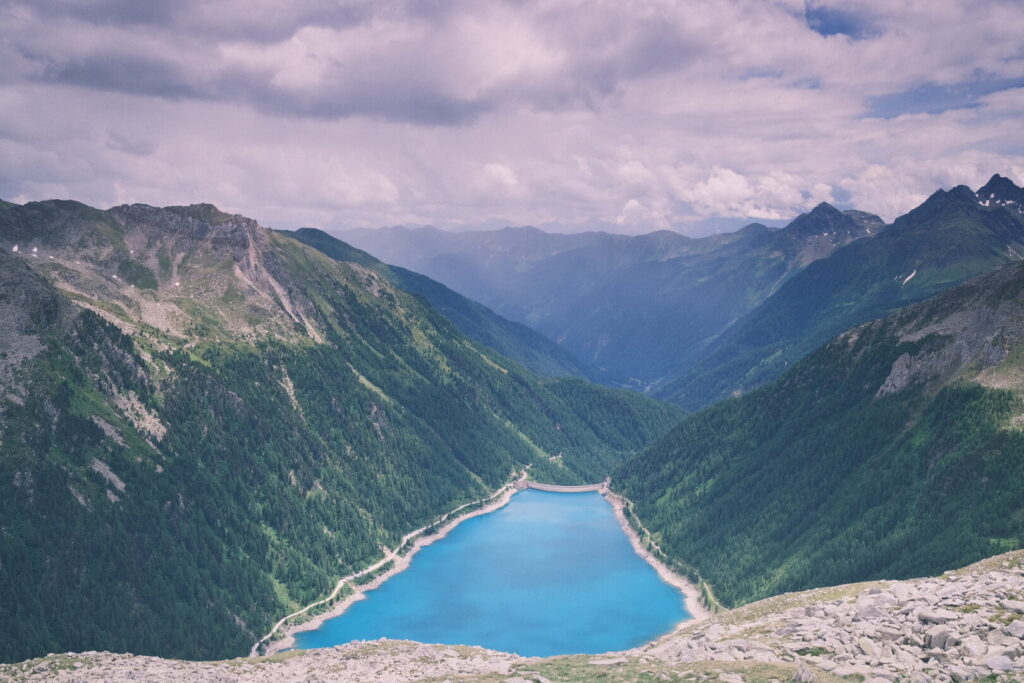 The trail continues up and down and arrives after around 10km to the modern looking Edelraut mountain hut. A great opportunity to take a rest and try some cake. Just below the mountain hut lies the Eisbruggsee backed by green hills and mountains towards the Dun valley official endpoint of this Via Alpina stage.
 From here you have two other options to continue. Either climb up to the Hochfeiler alpine hut which involves crossing the Gliederferner glaciar or walk on the Pfunderer Höhenweg up to Gaisscharte an extremely narrow rock gap which involves some secured climbing and enters a pretty wild environment. I opt for the second option and continue my walk towards the Gaisscharte. The trail is almost non existing and leads over big rock fields which makes it time intense to get ahead and the scrambling is hard especially with a big & heavy backpack. On the last section the Gaisscharte I encounter a herd of ibexes on their dinner. I climb up further until I reach the place where a 20 metres vertical section must be overcome which is especially tricky and demanding with the additional weight of a heavy backpack. On the top the gap between the rocks is as narrow to fit exactly a human body and on the other side a dramatic mountain scenery appears on the horizon.
 Descending into a steep valley again many block fields must be scrambled until the underground finally gets more grassy. In the far distance I can recognise the Walter-Brenninger Biwak a rustic emergency hut built from wood with a stone shell. It is a lovely place with a lot of details and you find everything you need for a shelter in the mountain even a toilet. In front of the bivouac a bench & table provide the perfect location to cook and eat a meal. I am more tired than expected of the hike of today and go to bed directly after dinner. The section of the Pfunderer Höhenweg is demanding and requires quite some time and effort but will compensate with some truly beautiful scenery and absolute tranquility.
Day 7: Brenninger Biwak-Pfitscher Joch
| Distance | Up | Down | Time |
|---|---|---|---|
| 14km | +1300m | -1150m | 6h |
The sleeping in the Walter-Brenninger bivouac is perfectly deep and I do not wake up together with the rising sun for once. Outside mist is ascending from the valley when I start my walk and gaining altitude the surrounding mountains disappear behind fog. After the first kilometres continuing on the path of the previous day the trail coming up from the Dun valley is rejoined and climbs further up towards the Gliederscharte on 2644 metres above sea level. Arriving on the highest point of today’s walk opens up the view to the highest peaks of the Zillertaler Alps and its glaciers from the west. Towards the north the snow capped mountains of the Tux mountain range are partially visible behind clouds. Down below the Unterberger valley
awaiting me.
 On my walk down already reaching the base of the valley looking back up to the pass darkest clouds are visible announcing a heavy thunderstorm. I try to increase my walking speed to get faster down the valley and its pine forests. Rain starts soon and I still need to climb up 500 metres to the Pfitzer Joch where the oldest, private-run alpine hut in South Tyrol. A heavy hailstorm goes down over me on the final ascent luckily some pine trees offer some limited shelter before moving on. The remaining walk is accompanied by strong winds and almost no sight due to fog. Short before arriving finally at the mountain hut another cell with thunders and blizzards go down over me. In the meantime I am soaked but I am glad to be on a place with a roof and some food.
Day 8: Pfitscher Joch-Friesenberghaus
| Distance | Up | Down | Time |
|---|---|---|---|
| 14km | +800m | -600m | 4.30h |
The Pfitscherjoch marks the border between South Tyrol and Tyrol and after a few 100 metres I am entering Austria one more time which lost the southern Tyrolean territories to Italy which led to a oppressive conflict over many decades.
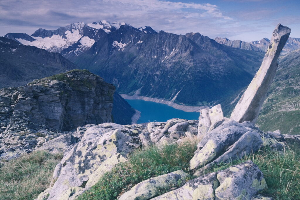
The Via Alpina route proposes to walk down through the Zams & Zemm valleys towards the Zillertal valley. I prefer to stay above the valleys and walk along the Tux mountain range on an altitude of around 2000 metres with constant views to the Zillertaler Alps from northeast for the next two days. Today my route leads above the Schlegeisspeicher dam first to the Olperer Hütte and from there to the Friesenberghaus.
 The Olpererhütte originally serving as base for climbing tours to the Tux mountain range is nowadays the destination for countless tourists coming up here just to make a picture on the close by suspension bridge which got famous through Instagram. Walking over the bridge which gives you the feeling of misuse makes you enter again a peaceful mountain scenery with few walkers. The weather is unstable again and the mountains are covered by dense clouds early in the day already and first precipitation at midday. The walking over increasingly big wet stones requires special care. On the final climb down to the Friesenberg lake the rain gets stronger and again I arrive soaked at the mountain hut which is packed with hikers. The Friesenberghaus is the first stop on the popular Berliner Höhenweg and I am lucky to get some of the last available beds for tonight.
Day 9: Friesenberghaus-Gamshütte
| Distance | Up | Down | Time |
|---|---|---|---|
| 15.5km | +750m | -1250m | 6h |
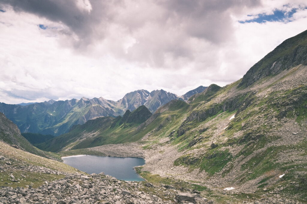
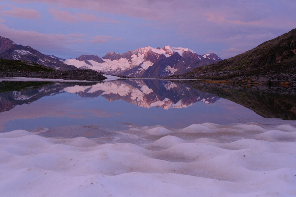
Early in the morning I sneak out the dormitory and walk down to the Friesenbergsee still in a deep winter setting. The peaks and glaciers of the Zillertaler Alps are reflecting on the calm surface of the lake.
 Back in the mountain hut a great breakfast with freshly prepared vegan options is awaiting me: a great exception in the world of alpine huts. Already the dinner came with a delicious vegan Dal. In the evening the hut custodian made a speech with helpful information regarding mountain conditions and best practises. Today a long balcony walk high above the Zemm valley leads to the Gamshütte. The first kilometres go through large blockfields before the trail descends to lower altitudes with a changing vegetation.
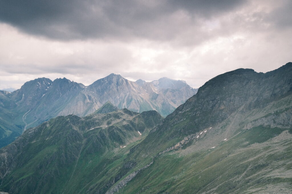
 The views of the mountains on the other side of the valley are dramatic and show different side valleys cutting into the mountain range. The weather today is more stable than the past days allowing for great vistas of the Zillertaler Alps during the whole walk. The path is characterised by many shorter uphill and downhill sections making it quite tiring until the end. Especially the last stretch over mud trails on steep grass slopes is exhausting and the trail should could turn into a nightmare in wet conditions. I am grateful to arrive dry to the Gamshütte a small and basic mountain hut which puts high importance on sustainability and environmental matters making all activities transparent to guests.
Day 10: Gamshütte-Mayrhofen
| Distance | Up | Down | Time |
|---|---|---|---|
| 12km | +50m | -1300m | 3h |
Day 11: Mayrhofen-Loassattel
| Distance | Up | Down | Time |
|---|---|---|---|
| 27.5km | +1800m | -800m | 6.45h |
Day 12: Loassattel-Schwaz
| Distance | Up | Down | Time |
|---|---|---|---|
| 15km | +600m | -1550m | 5.15h |