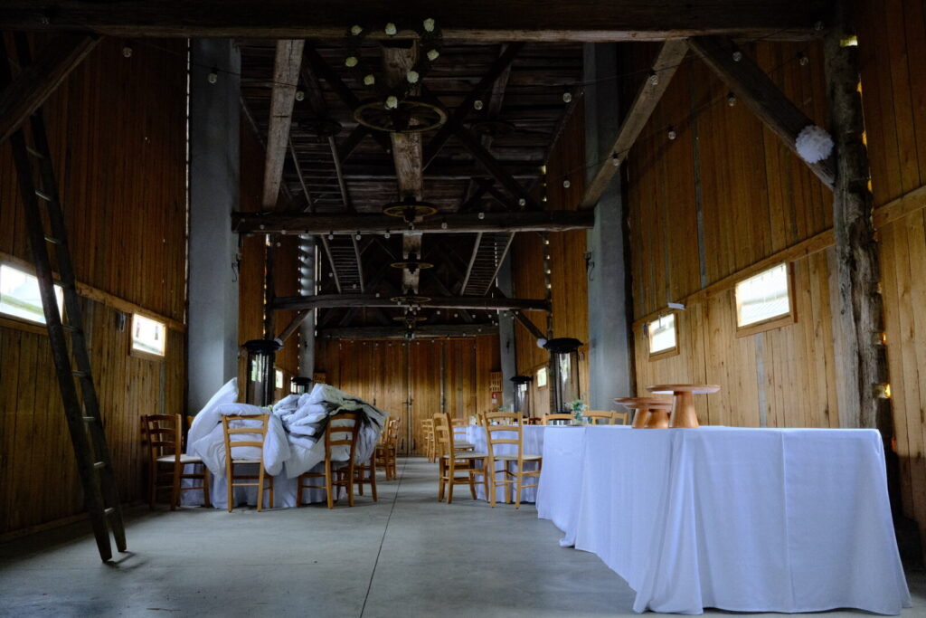
Day 1: Trieste/Muggia-Draga
| Distance | Up | Down | Time |
|---|---|---|---|
| 19km | +800m | -450m | 4.45h |
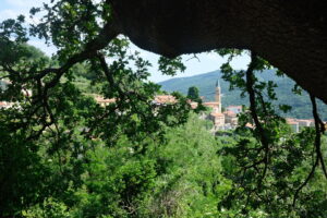
Its a hot saturday in Trieste in the north-western corner of Italy close to the border with Slovenia. I get out early to the streets to breathe the awakening of the city and in search for some carry on food for the next days on the trail. After returning to the hostel in the heart of the city and a minimal breakfast I get my pack ready and walk to the harbour. Soon I enjoy a boatdrive from the big cruiseship city Trieste to charming Muggia just across the bay. I linger around ignoring the walk awaiting me. At noon with the sun already burning without mercy I start the walk and already short moments after leaving the town the path steeply goes uphill to Santa Barbara and down again almost to sea level just to conquer the highway. The trail now goes softly uphill again a wide valley and leaving the cost behind.
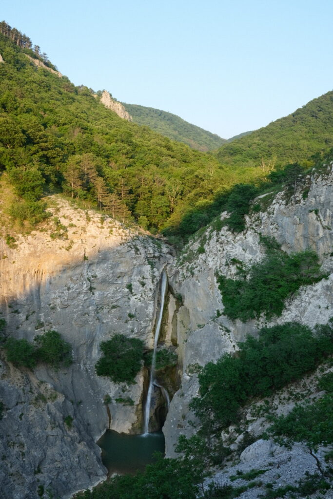
After passing various small towns along the valley and 15km after my departure I arrive at one of the lowest mountaineering huts located at just 150m above sea level. Somehow bizarre but the serve tasty italian food so perfect for an extended break. There is still a final uphill section to be tackled to reach Draga. After a delicious refill I move on my way through the pristine Val Rosandra with a beautiful waterfall and a basin on the remote end of the valley. After the final uphill attempt I arrive exhausted at Draga where I get a room after a challenging first day on the Via Alpina trail. I am tired but really happy my body managed that well the load coming with such activities. After such a long time without any sportive activity this is by no means a matter of course.
Day 2: Draga-Matavun
| Distance | Up | Down | Time |
|---|---|---|---|
| 18.5km | +500m | -450m | 4.45h |
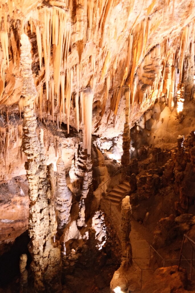
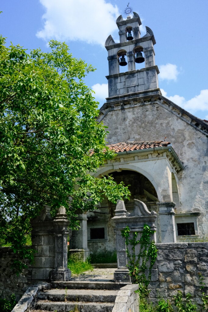
Today I start into the new day with a tasty and rich breakfast. If you ever are in the region search no further than Locanda Mario: Great place to stay! Compared to yesterday my departure is taking place already two hours earlier. Again with a steep uphill ascent and over Monte Cocusso to the border with Slovenia. At the nearby Kokos hut a lot of Slowenians enjoy their sunday out in the nature. The walk continues to Lipica famous for its oldest studs in Europe. I just caught a glimpse of the horses from the distance as I walked further to the Vilenica caves probably the oldest worldwide. As I arrived 30 minutes before the weekly guided tour I decided to submerge down the earth to experience these beautiful formations.
 After this touristic break another 8km section connected me with Matavun home to the world famous Skocjan caves and its underground gorges.
For the night I am stranding at the Hostel Skrla which appears abandoned apart of 4 cyclist from the UK who are riding from Nice to Split during one week. The hostel has a backyard where I pitch my tent and a fully equipped small kitchen is waiting inside the house. What do I need more?
Day 3: Matavun-Razdrto
| Distance | Up | Down | Time |
|---|---|---|---|
| 17km | +550m | -350m | 4.15h |
The morning sun stands high and my tent is protected by a mighty tree. Its been the third night in a row falling into sleep far after midnight. This rhythm has to be broken soon. After the usual morning rituals and some talking with the cycling guys from Scotland the time has come to continue my path and move on to a new place.
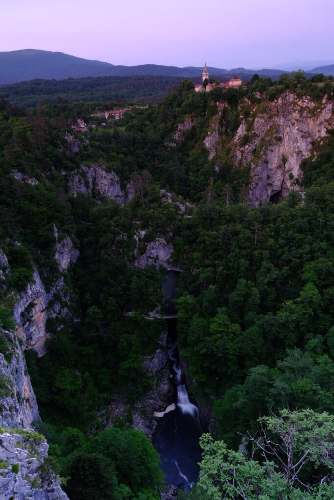
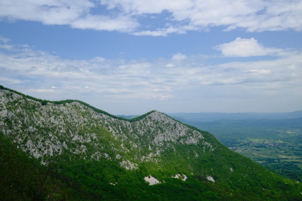
The route of today starts with the impressive Canyon of the Skocjan caves as seen from west and soon traverses into an uninhabited area including a small airport. For large parts its a solitude walk. After around 12km I arrive in Senoceke the main town between Matavun and Razdrto. It is here where I suffer some heavy stomach pain which reminds me that I am still impacted by the illness which has been my most faithful companion during the last weeks. After this intermezzo I cross an area of forests which leads to Razdrto and seems to be a real Snakelandia.
Day 4: Razdrto-Predjama
| Distance | Up | Down | Time |
|---|---|---|---|
| 16km | +800m | -900m | 4.45h |
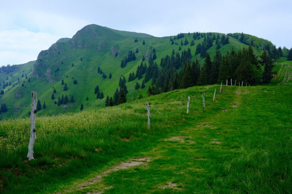
The sky is almost completely covered by clouds which makes me rub my eyes when I stretch my head out of the tent after a windy night. After 3 days of direct sun and the first “serious” climb it won’t be myself complaining. For once I skip the breakfast and go straight into action. Just outside if town the uphill section to climb mount Nano starts with a steep ascent. Most of the walk goes through forest and sometimes meadows are crossed. The rifugio Vojkova on the top of the mountain is currently being renovated as I realise when I arrive there after a 2h ascent.
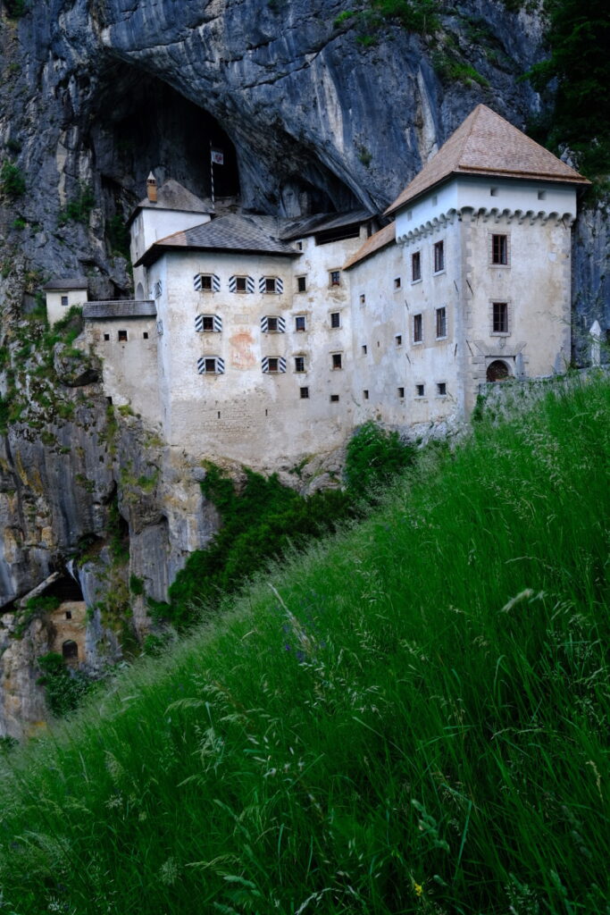
On the trail down towards Strane I do not encounter a single human. The path is winding through beautiful forests which provide a shelter from the strong winds on the Nano mountain. After Strane I pass through another sleepy peasant town before arriving finally to Predjama home to the world’s largest cave castle which was contructed in the 13th century into the mouth of a cave at the end of a valley.
Day 5: Predjama-Crni Vrh
| Distance | Up | Down | Time |
|---|---|---|---|
| 21.5km | +800m | -600m | 5h |
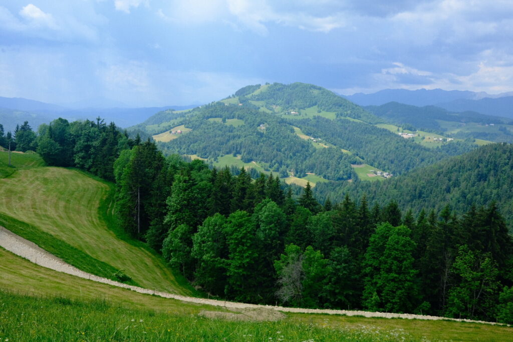
The sky is covered by clouds and the crowds are already streaming from everywhere to the Predjama Castle which seems to be a veritable tourist magnet with an understandable attraction for young and old people. I am already leaving all this behind climbing up steep out of Predjama into the forest. Luckily the trail flattens out pretty soon and continues on wide forest roads slightly uphill towards Hrusica. There is a small restaurant so I order a refreshment and fill up with a banana stored in my backpack.
Further on the trail up to mountain Javornik the highest point today I meet an 64-years old hiker from Swiss Romandie who wants to walk from Slowenia to Liechtenstein in one month. He had also walked trails like the GR5 through the french alps or the GR10 through the Pyrenees and he aimed to do the GPT, too (high on my personal list as well). The time runs faster you can ever walk with some interesting talk on the trail. After a short break at mountain Javornik we descend down towards Crni Vrh where we pitch our tents on a private run place with a huge garden in the backyard. Today’s walk has covered a distance of 21km which makes it the longest so far and I am pretty tired.
Day 6: Crni Vrh-Idrija
| Distance | Up | Down | Time |
|---|---|---|---|
| 11km | +200m | -500m | 2.5h |
Today I plan to have some kind of a recovery day. Its a short and pretty flat walk into the mining town Idrija which features the second largest mercury mine worldwide and is labeled as an UNESCO world heritage site nowadays.
The trail ascends very softly out of Crni Vrh passing by smallish settlements before descending steeply down into the Idrijca river valley. From here I reach Idrija along the green, crystal clear Idrija River which flows into the Soca River in the Julian Alps. Idrija is surrounded by green hills and the landscape is more and more characterised by mountainous hillsides now. My final ascent from the center of town to the youth hostel results in useless burnt energy. All the 50 beds (and more…) are occupied by a large group so I wander through town in search for a B&B to rest and spend the night. In the end I find a quiet one at the edge of the historic center.
After a week of stable weather dark clouds are appearing on the horizon for next week (a lot of rain and increased thunderstorm risk). This is somehow worrying as I am entering the Triglav national park soon and especially the ridge walk on the southern Bohinj mountains is dangerous with bad weather.
Day 7: Idrija-Podlanišče
| Distance | Up | Down | Time |
|---|---|---|---|
| 24.5km | +1350m | -750m | 6.15h |
Already soon after leaving Idrija behind the trail arises steeply through the forest leaving the Idrijca valley below. It is hot and sweat pearls are pouring down. The typical clouds announcing summer storms are towering up already early in the day. After a demanding ascent the route runs over the Idrija and Cerklje hills passing multiple settlements, farms and meadows almost always overlooking the Idrijca valley.
 Every now and then local thunder cells bring some rain which I use to make some breaks on the closest shelter. Its already late in the afternoon when I reach Podlanišče a dispersed settlement in the hills southeast above Cerkno and the landscape has a strong similarity to the Emmental valley back home.
Here Damjan and Mojca have built a unique project on their farm where marriages can be celebrated in a incredibly beautiful environment. They are also offering their farm as a home for hikers to pitch their tent for a night and use a small and rustic cabin with a fully equipped kitchen and next to it toilets and a shower. It obvious they put a lot of love and energy in this project and I am impressed how they share this place without expecting anything in exchange.
Day 8: Podlanišče-Pozeren
| Distance | Up | Down | Time |
|---|---|---|---|
| 16.5km | +1250m | -600m | 5.15h |
Its been a rainy night with some serious thunderstorms passing over sending down some lightning’s luckily at some distance. The couple from Switzerland who I had met on the trail between Predjama and Crni Vrh have already spent the night on the farm but are already gone early in the morning. I am still in a lazy mode and prefer to sleep in the morning.
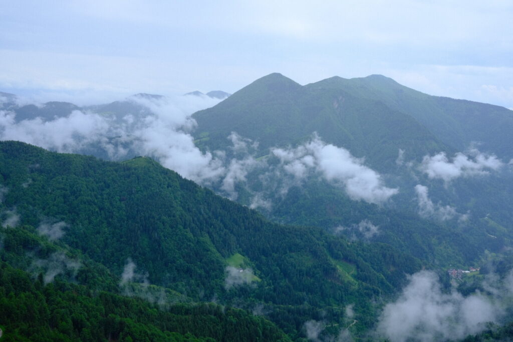
The sky is covered in clouds and the air is wet as is my tent. I decide to get onto the trail as soon as possible. The first section descends down through the Cerklje hills mainly along an old road and afterwards across forest and grassy slopes. The road was built after World War 2 by the Italian Fascists. Down in the valley the path leads towards the Franja Partisan Hospital which was a secret and clandestine World War II hospital hidden within the wild and stunning landscape of the Pasica gorge. It was run by the Slovene Partisans from December 1943 until the end of the war as part of a broadly organized resistance movement against the Fascist Italian and Nazi German forces and served as a safe space for wounded anti-Nazi resistance fighters in World War II. To guarantee absolute secrecy patients were even blindfolded to keep the exact location secret. Further on the trail its a long and especially in the beginning highly steep climb through forests and pastures to the Porezen mountain which offers superb views to the Bohinj range and the Triglav group. Due to the unstable weather these days the view is part of an imaginary process though luckily some sun rays find their way through the clouds in the late afternoon and surprisingly the weather stayed dry during the whole day. Less surprisingly the the others from last night made it up to the mountain hut, too. Even tough we were the only three overnight staying guests the people on the hut prepared a filling meal and its been a long time since I ate that much.
Day 9: Pozeren-Bohinjska Bistrica
| Distance | Up | Down | Time |
|---|---|---|---|
| 18km | +550 | -1550m | 5.45h |
Since some days I have been considering skipping the Lower Bohinj mountains ridge due to bad weather and security implications while hoping until the last moment to somehow find a way to still make it happen but now just few moments before today’s departure he decision is final: I need to deviate from the official Alpina route and cancel the first personal highlight. I will follow the official route until the Vrh Bače saddle and from there descend on the Juliana trail until the village Bohinjska Bistrica. On the first stretch down from Porezen until Petrovo Brdo I am accompanied by the couple from Winterthur who will continue hitchhiking to Ljubljana. After a short break and saying goodbye the uphill section of around 4 km is starting. Its a mystic atmosphere when walking through the foggy forest which offers some shelter from the rain which gets more intense. After some time I am soaked anyway. After endless 1.5 hours walking in the rain I finally reach Vrh Bače a panoramic saddle and pass from which a nice view opens up on Porezen and Baška grapa below which served as strategic vantage point on the World War II frontline.
Here the trail crosses the Vallo Alpino, where defensive bunkers were built along Italy’s northern border before World War II. A labyrinth of abandoned military passageways and tunnels can be explored. The rain gets less intense and completely turns off following the Juliana trail descending into the Bohinj valley on the other side of the saddle which makes the downhill section on the wet underground a little bit more pleasant. After 5.5h walking time I am entering Bohinjska Bistrica a currently pretty sleepy touristic town just outside of the Triglav National park and few kilometers away from lake Bohinj Slovenia’s largest lake. Its the perfect place for the first day-off as tomorrow will be a day of nonstop rain. A day I prefer to use for planning the route through the Triglav. I set foot into a hostel with all the amenities like a well equipped kitchen and comfy common area.