Day 1: Wolfratshauserhütte-Weissenbach am Lech
| Distance | Up | Down | Time |
|---|---|---|---|
| 26km | +800m | -1600m | 6.5h |
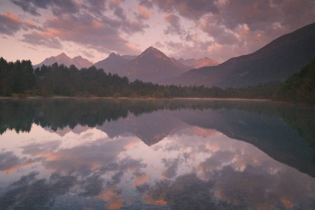
From the Wolfratshauser mountan hut I head down into the Gartnertal valley to ascend again to the Sommerbergjöchle through meadows always below the Gartner wall which is however hidden by fog. On the other side of the saddle we are looking down into the long Berwang valley which we will walk down for the next 1.5 hours before arriving to the village Berwang on a tender uphill walk. In Berwang, whose name derives from the words “Bär” (bear) and “Wang” (meadow), I run into the Luce & Xavier the french couple I met on the Meilerhütte. We continue the long downhill walk of almost 15km through the Rotlech valley together to finally arrive at the town Weissenbach and the Lech river considered Europe’s last wild river. Here the river Lech has a very wide and mainly untouched river bed, where many smaller streams wind through the vast gravel banks depending on the water levels. We decide to walk further along the Lech river out of Weissenbach to shorten the next day long walk into the Lechtal and Schwarzwassertal valleys. 3km after leaving Weissenbach and walking on a beautiful natural trail we stop at the beautiful and idyllic Baggersee a popular recovery place where many people come for a swim or a barbecue. As the weather is warm here in the valley and camping is officially not allowed at the lake and the whole Lech valley we spend the night directly at the shore of the lake under the starry sky.
Day 2: Weissenbach am Lech-Prinz Luitpoldhaus
| Distance | Up | Down | Time |
|---|---|---|---|
| 22.5km | +1350m | -450m | 6.45h |
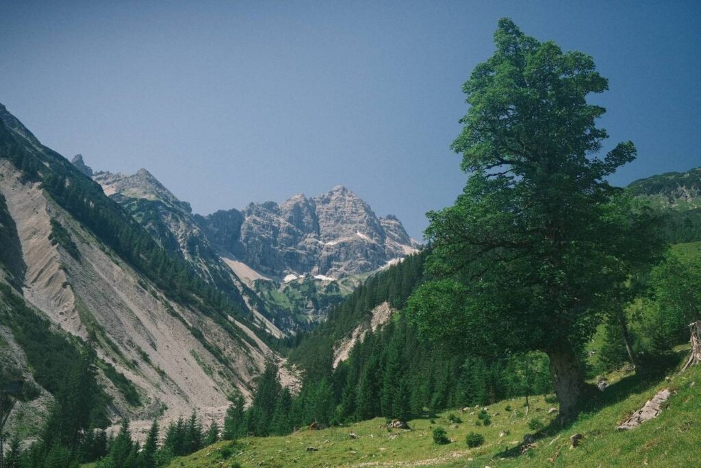
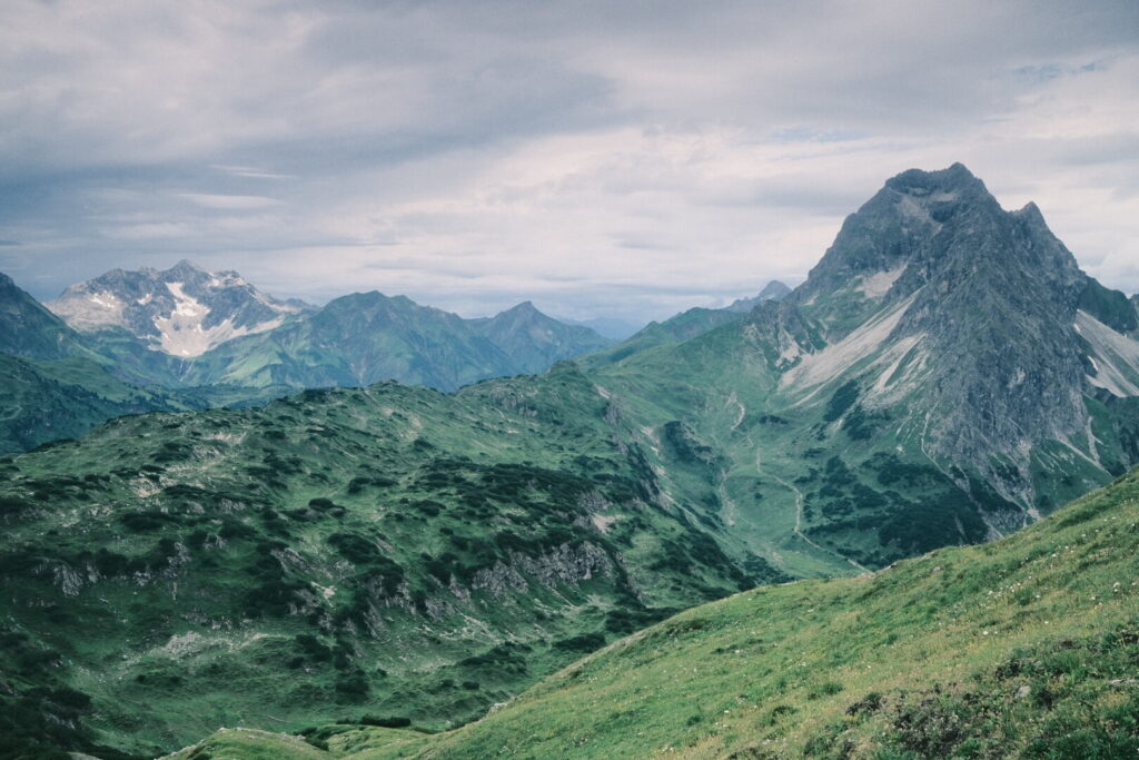
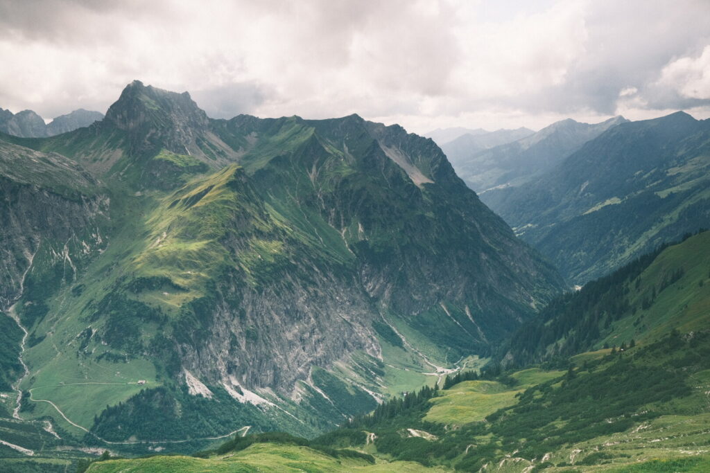
Today’s walk lead for around 15 kilometres through the Lechtal and Schwarzwassertal valleys before climbing up 1000 metres to the eastern part of the Allgäu Alps dominated by the Hochvogel mountain a massive rock pyramid also called the Allgäu Matterhorn. A big crack in the mountain is expected to cause big rockfalls with up to 260’000m3 of rock thundering towards the valley on the southern side earlier or later. No clouds are visible during the long valley walk on a gravel road and the sun is heating up the valley floor already early in the day. After around 5km we are leaving behind the Lech valley and turn right into the Schwarzwassertal valley where we walk high above a ravine and the Schwarzwasser stream after an initial ascent.
Towards the end of the valley the gravel road ends and the trail looses itself. The oncoming section is poorly marked but with gps assistance we climb up to the Obere Lichtalp and from there to the Bergwacht hut located just 300 metres below the Bockkarscharte saddle. However the sky has changed from blue to a dark curtain in few moments and I am sure something heavy will roll on pretty soon over our heads and we decide to stay at the hut which provides some minimal shelter. Not too long later a powerful thunderstorm has arrived together with strong winds and rain. After the worst part has passed by we embark on the last stretch up to the saddle accompanied by light rain. Approaching the saddle the winds get stronger and stronger and at certain points you can only withstand the raw powers by holding on to nearby rocks. A heavy wind gust blows away my backpack’s raincover down the mountain forcing myself descending again leaving my backpack at the saddle. After this extra round I continue the downhill path from the saddle over grassy slopes where the winds find perfect conditions to get fast & strong. After a exhausting struggle and the last stretch which is more quiet again leaving behind the ridge the Prinz Luitpold mountain hut gets closer and I have arrived in the Allgäu Alps. The eastern Allgäu also marks the border line between Bavaria and Tyrol which we have left now behind definitively on the Via Alpina route
Day 3: Prinz Luitpoldhaus-Oberstdorf
| Distance | Up | Down | Time |
|---|---|---|---|
| 20.5km | +500m | -1500m | 5h |
The Prinz Luitpoldhaus is the oldest alpine mountain hut in the Allgäu Alps and probably also one of the biggest offering room to almost 300 people while last night “only” 110 beds were occupied. The hut stands out as it was the first hut from the German alpine club which has adapted their menu completely to organic and tries to work with regional vendors and they do their best to offer some vegan options, too.
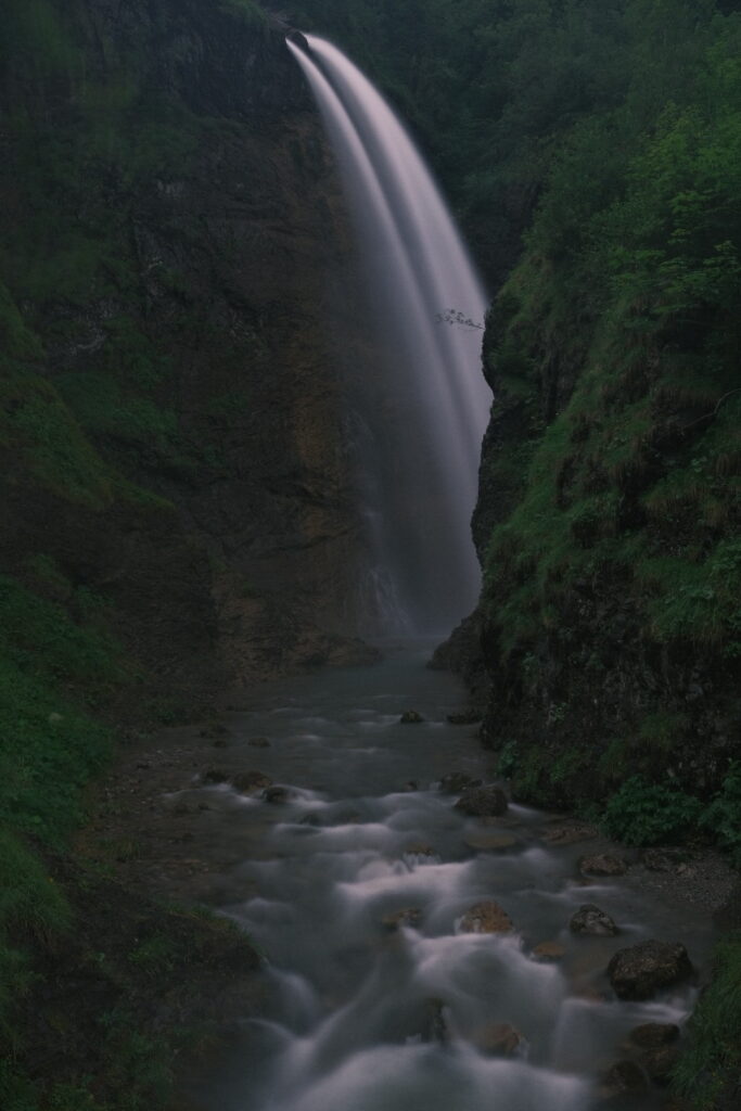
Outside the window the mountains are hidden by clouds and this will not change much during the day so the famous grass mountain Höfats will not be visible. The walk towards Oberstdorf is initiated by traversing below the Allgäu main ridge over wet slopes and crossing various streams before heading up to the Himmeleck saddle into dense fog. On the other side the trail leads down through different alpine pastures into the Oytal valley where water comes down from all sides and waterfalls can be spotted after each turnaround.
Descending into the valley and getting closer to Oberstdorf more and more tourists populate the walking path. Oberstdorf itself is a typical upscale tourist resort which reeks of money and luxury with the usual stores selling products nobody really needs. I feel reminded to Mayrhofen in Tyrol and luckily the campsite lies quite some distance northwards out of town. The campsite is pretty tiny & minimalistic but offering all you need including a common kitchen
Day 4: Oberstdorf-Guggersee
| Distance | Up | Down | Time |
|---|---|---|---|
| 16.5km | +1000m | -100m | 4h |
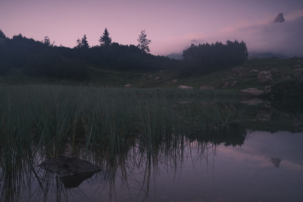
The weather forecast for today is remarkably stable and will remain the only one without rain during my time in the Allgäu Alps. Its already noon when I head off towards the center of Oberstdorf and from there southwards through the Stillach valley. The first section is again populated by many hikers especially around the ski-flying hill of Oberstdorf. After around 10km flat valley walking I arrive at Birgsau from where the trail will enter some serious incline to get back up to the mountains. The trail leads up to the Walsertaler mountains and the natural mountain lake Guggersee from where one could enjoy a splendid panorama of the Allgäu main range on the opposite side of the valley if no clouds hide the mountain peaks. I pitch my tent in short distance to the lake and every now and then the mountains get partially visible above moving clouds at nightfall.
Day 5: Guggersee-Widdersteinhütte
| Distance | Up | Down | Time |
|---|---|---|---|
| 14km | +800m | -500m | 4h |
Early in the morning the sky is covered in clouds and the weather forecast had announced some serious bad weather to arrive already in the morning. Indeed it feels like the calm before the storm up here in the outermost angle of Germany. The plan is to start walking early enough to arrive at the Mindelheimer mountain hut to sit out the worst part. The path follows the southern slopes of the Walsertaler mountains some hundreds metres below the ridge line ascending gently to an altitude of 2000 metres. After not even 1 hour the thunder growling gets closer and the sky is darkening. Few minutes later the centre of the storm is over my head and strong rain falling on me. Blizzards are going down and I have no choice than waiting on a relatively safe spot. After these days and this very moment I start to understand why all these steep slopes in the Allgäu Alps and its grass mountains are that green and not from nothing this is the area in Germany with the highest precipitation. As the storm moves on eastwards over the mountains I continue my walk under soft rain and bitter cold winds. My clothes are soaked and heavy and after one more hour I am finally approaching the Mindelheimer hut where I will rest some time to dry up a little and eat something. Luckily in that corner there is mobile network coverage again so I can identify a 2 hours window after noon to make it to the Widderstein mountain hut situated roughly 8km away. After this short but very welcome break I move on ascending further up to the Wildengund saddle on an altitude of 2172 metres above sea level. From here a vast panorama over the main range of the Allgäu alps in the southern-east, towards the peaks of the Lechquellen mountains and the Braunarlspitze until the Walsertaler mountains in the southern-west with its striking Widderstein mountain. The southern foot of the Widderstein is today’s destination and the Braunarlspitze will be objected tomorrow. Despite the rather poor weather I can enjoy this impressive mountain landscape which is my personal highlight of the Via Alpina route through the Allgäu Alps.
The trail continues down to the Koblat pass which marks the borderline between Bavaria and Vorarlberg. From here its a up and down walk in the last part again with rain towards the Widdersteinhütte mountain hut. Its a private run tiny & classic mountain hut with just one dormitory for 18 people directly below the southern side of the Widderstein mountain. Its a Friday and the hut is just a one hour walk away from the road at the Hochtannbergpass so today the bad weather saved me a bed for sure. And its another place with vegan options for dinner and breakfast and one of the few mountain huts with drinkable tap water. The price tag is rather on the upper limit but especially after such a wet day you wouldn’t care too much on the number on some piece of paper. After a filling chickpeas curry with rice I fall asleep early perfectly knowing about two strenuous days laying ahead of me.
Day 6: Widdersteinhütte-Sonntag
| Distance | Up | Down | Time |
|---|---|---|---|
| 30.5km | +1000m | -2200m | 8h |
A long and demanding stage is planned for today as I aspire to get from the Allgäu Alps through the Lechquellen mountains and down into the upper Grosswalsertal valley. During the morning clouds are hanging deep hiding the mountains and fog is coming up from the valley. From the Widdersteinhütte I descend down directly to the Hochtannbergpass where the Allgäu Alps end and the Lechquellen Mountains area starts. Many hikers drive up here by car to walk up into the mountains and surroundings. I continue to the nearby Körbersee once voted the most beautiful place in Austria and nowadays probably the reason most people come here. I further descend towards the town Schröcken but leave the official Via Alpina route at the Bregenzer Ach a stream and river flowing into lake Constance after its journey through the Bregenz forest another alpine area. Instead of descending down to Schröcken and further along the Bregenzer Ach I climb up into the wild Felltal valley towards the Braunarlspitze and its glaciers which are hidden by clouds. At the distance the melted water is falling down through waterfalls into the valley. The trail is heading up to an altitude of 2150m above sea level to the Fürggele from where we could climb further up to the summit of the Braunarlspitze nothing less than the highest one in the Lechquellen Mountains range. Instead I follow the hikung path down which leads around the massive Braunarlspitze group and views down into the still far away Grosswalsertal valley and the striking Feuerstein mountain towering above.
A short walk away lies the Biberacher Hütte mountain hut which is packed with hut tourists on this Saturday afternoon and I just stop here for a short time before a long descent into the valley. The first section runs along grassy slopes and karst rock to the beautiful alpine meadow Ischgarneialpe with great views back to the Braunarlspitze. The remaining downhill trail runs on a tight track which seems quite unofficial until reaching the valley floor and the Lutz river past the Kessischlucht gorge running in the underground. From now on its a pretty flat valley walk along the Lutz river leaving aside settlements called Buchboden and Sonntag. It’s getting dark and I keep an open eye for a spot to pitch my tent. After over 30km and an altitude difference over 3000m I am exhausted and ready for some recovery time as the next day is expected to require again to cover more than 30km.
Day 7: Sonntag-Feldkirch
| Distance | Up | Down | Time |
|---|---|---|---|
| 32.5km | +800m | -1100m | 7h |
It feels like having slept in a cave. Inside and outside my tent is wet and small streams of waterflows are running down and I placed the tent on the valley side with morning shade. It is obvious I am new into the game of valley wildcamping. After some cereals for breakfast and a wet tent out of my mind hidden on the bottom of my backpack the journey must go on. Its a long, long walk on the Walser trail through the Grosswalsertal valley going up and down through forests and meadows and crossing smaller settlements like Blons or the monstery St. Gerold.
The Grosswalsertal valley was first settled by mercenaries from Valais (the Walsers) & Grison during the 13th century bringing the German language to this (and others) region(s).
Arriving at Thüringerberg marks the end of the Grosswalsertal valley and the wider Walgau valley. From here we can recognise the surrounding mountain ranges like the Rätikon to the south and the Alpstein further away to the west behind the Rhine valley. Getting closer to the Rhine valley we are approaching Austria’s westernmost town Feldkirch through a rather unexpected industrial manner. Along the powerful Ill river the trail crosses bridges & viaducts of highway and train routes before entering this well preserved medieval town which shows a completely different face in its centre. Clean, touristic and with an intelligent developed trail system for cyclists and pedestrians through a labyrinth of neighbourhoods and over bridges decoupled from car traffic. This network including the bridges seems quite new as it is not yet drawn onto many maps. After having crossed the town centre I head some more kilometres northwards to an official camping.