Day 1: Scuol-Müstair
| Distance | Up | Down | Time |
|---|---|---|---|
| 29km | +1200m | -1100m | 6.30h |
Today another long stage of almost 30 kilometres is awaiting me crossing the Sesvenna mountain range through its lower passes, touching the longest existing National Park in the Alps and finishing by arriving in the Val Müstair. The breakfast buffet in the Scuol Youth Hostel offers a great selection and helps to prepare for a long day on the trail. Outside the sky is covered with clouds and some light rain might occur in the morning. From Scuol I head down around 100 metres to the Inn river. Its the second but not last time we cross this river on the Via Alpina and compared to the wide river in Tyrol it seems tiny and natural here in the Engadine valley. The trail climbs up now to the nearby Vulpera settlement where we enter the Clemgia gorge on a narrow path and over wooden bridges crossing the wild stream multiple times. 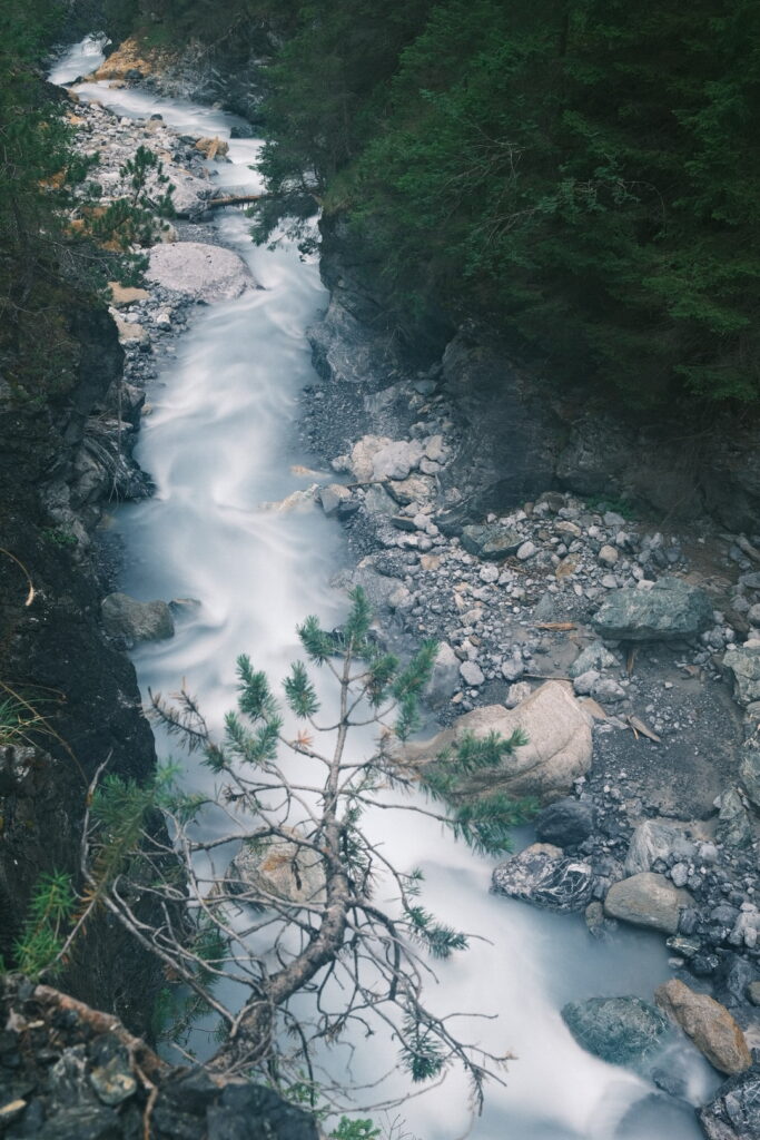 Large areas of this trail were destroyed by a storm some years ago but recently reconstructed. It seems only a question of time until future landslides and the gorge looks quite fragile. After some kilometres trough the gorge the trail climbs up and joins an old unpaved mountain road which follows the S-charl valley for many kilometres until S-charl. This route is even covered by the Postauto bus line from Scuol during the summer months and many cars drive up here, too. Due to the low incline it seems also a popular cycling route but I did not encounter any other hikers walking up through the valley. On the other side of the Clemgia river is the border of the Swiss National Park and the Piz dals Vadez and Piz Pisoc mountains two of the highest peaks of the Sesvenna Alps raise high above. At the National Park entrance the road and the Clemgia stream turn left and the two mountains are now visible together with the water flow.
 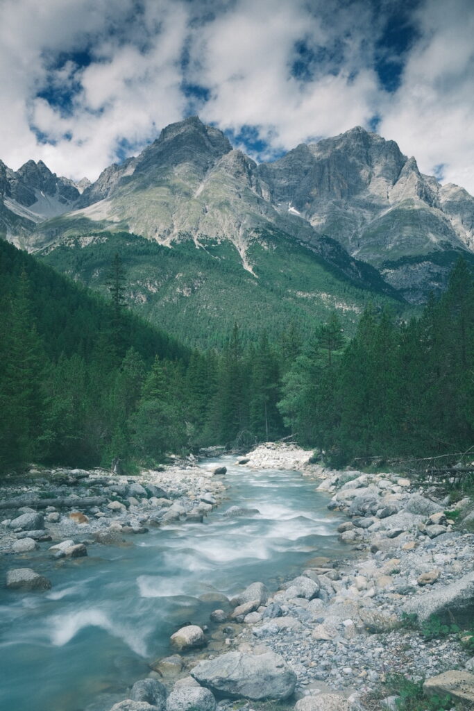 Soon S-charl is reached a small settlement with some restaurants and different walking trails. From here the Via Alpina continues still smoothly uphill on a mountain road until Plan d’Immez a meadow with picnic tables. Here we turn left further uphill until the S-scharljoch saddle on the border between Switzerland and Italy just next to the Sesvenna mountain the highest peak of the Sesvenna Alps. From start to end the incline is minimal distributing an elevation difference of 1200 metres over a distance of 20 kilometres making it a long but pleasant uphill walk. On the Italian side the descent runs over a rocky trail just for a short section before continuing on a alpine pasture road down into the Avigna valley with views of the massive Ortler mountain and its spectacular glaciars. However most of the mountain is covered by clouds today but the Via Alpina runs turning around this mighty mountain most of the time during the next two days so hopefully I can enjoy its full beauty soon. Descending further down the valley I switch back to Switzerland over the green border to spend the night on the camping of Müstair and climb up 1500 metres to the Ortler Alps tomorrow. This is a shortcut variant compared with the Via Alpina routing adding some beautiful views on top, too.
Day 2: Müstair-Stilfser Alm
| Distance | Up | Down | Time |
|---|---|---|---|
| 12.5km | +1500m | -650m | 4.15h |
A rather short stage into the Ortler Alps with a steep climb gaining 1500 metres of altitude to the most eastern point of Switzerland before descending into South Tyrol lays ahead. The night on the camping in Müstair was warm with temperatures not falling below 15 degrees Celsius. One last summer night before the next nights around the freezing grade which are to be be expected together with snow and chill winds.
The climb up to Piz Chavalatsch is steep and exhausting but luckily with morning shade and a stream at half distance. The first kilometres run through the forest steadily uphill but with an intelligent path. The trail puts no difficulties and after around 3.5 hours walking time I reach the surprisingly flat summit which is even equipped with a picnic table and offers space to pitch more than just one tent given perfect weather conditions. Because here the blizzard hit rate should be pretty high. Strong winds are blowing and most people skip the picnic on the summit today. During the day the sky got covered by fast moving clouds announcing the arrival of the cold and wet weather. The views from up here are splendid in all directions offering views over the Sesvenna & Ortler Alps, the Swiss National Park, the Müstair & Vinschgau valleys. On the way down the clouds around the Ortler mountain clear up for a short moment perhaps the last chance to enjoy a view to the whole mountain during the next days. 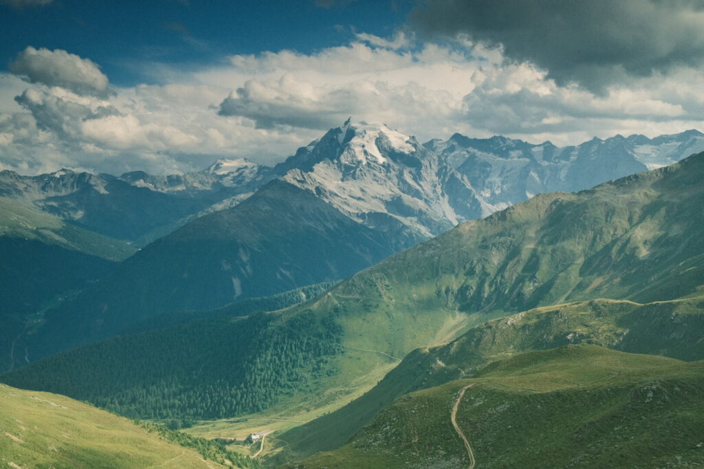 Arriving at the Obere Stilfser Alm I ask to stay the night here and they offer me to sleep in the barn for free.
Day 3: Stilfser Alm-Lago di Cancano
| Distance | Up | Down | Time |
|---|---|---|---|
| 31.5km | +1500m | -1650m | 7.45h |
In the end I stayed three nights at the Obere Stilfser Alm due to the poor weather conditions. There was a lot of rainfall and snow in higher elevations during the past two days and temperatures have dropped significantly. The nights were pretty cold in the barn but during the day I could stay inside the building. The Obere Stilfser Alm functions mainly as a hut which prepares typical tyrolean mountain meals for hikers & bikers. Apart from lunch time its quiet calm at this place and I could use the time to write for the blog and do some planning for the oncoming days. Today I want to walk up to the famous Stelvio pass road, entering Lombardy and continue to the Cancano reservoir. I am expecting an absolutely demanding stage at the upper limits due to the long distance of over 30 kilometres and the harsh weather conditions. The precipitation should be minimal today but the temperatures will be low paired with strong winds. When I leave behind the Stilfser Alm alpine around 6 o’clock its still bitter cold from the night and I am wearing three layers of clothes and liner gloves. During the night the sky cleared up and the weather should be stable in the morning which is why I leave so early. The path runs between 2000 and 2200 metres towards the Furkelhütte where it joins again the official Via Alpina route which starts in the valley from Stelvio more than 800 metres lower in altitude so I am happy to have started on an altitude over 2000 metres already. Between the Furkelhütte and the passo dello Stelvio I walk on the Goldsee trail a balcony panorama trail running high above the Trafoi valley with the Ortler mountain and its massive glaciers/ always in eyesight. 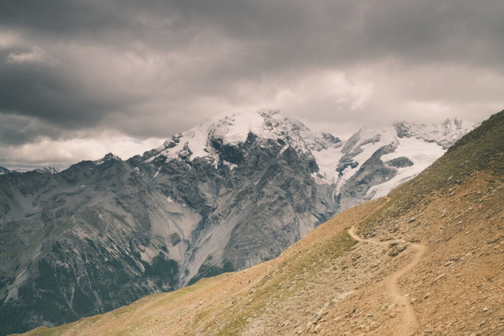 During WW1 the frontline of the alpine warfare of the white war went directly through the Ortler massive from Monte Scorluzzo to Monte Ortler. Habsburg-Austrian troops had gun batteries here on the highest altitude of the whole mountain warfare during three years to avoid Italian alpini troops to advance further into the valleys. At the Goldsee artillery fortress the Ortler frontline is visible through the trenches and ruins of the war fortress.
 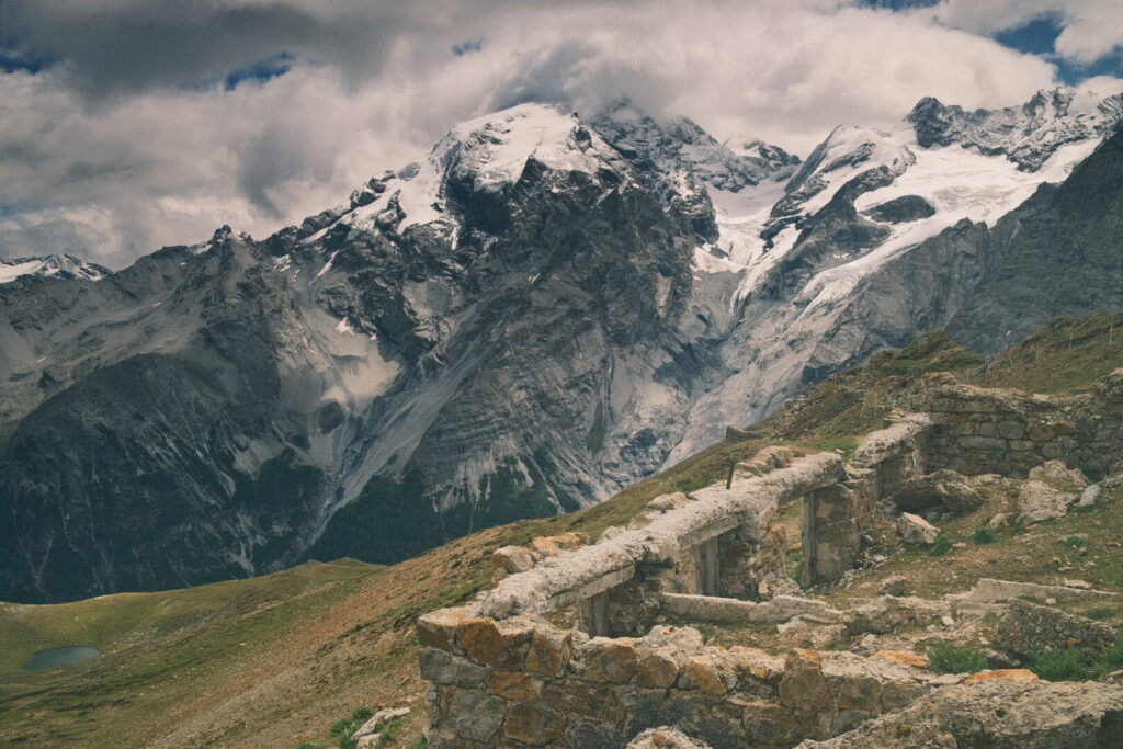 Moments after leaving behind the Goldsee artillery fortress snow starts to fall down on the final leg to the Stelvio pass. The trail ascents up to the Dreisprachenspitze a minor peak on 2843 metres just above the Stelvio pass. It refers to the three linguistic regions which meet here: South Tyrol (German), Lombardy (Lombard) and Graubünden (Romansh). The temperatures are below zero and the cold wind contributes to the nasty weather. Descending down to the Stelvio pass the place is crowded by tourists arriving here by car or motorcycle but also cyclists conquer the pass under the falling snow. It is the highest paved mountain pass in the Eastern Alps, and the second highest in the Alps, so no wonder this is one of the most touristic places in the Alps. The famous and scenic hairpin road leading up to the pass from the south-tyrolean Vinschgau valley side is hidden by fog though. I continue my way down into the Braulio & Valtellina valleys on the Lombardy side westwards towards the lower Umbrail pass after all the highest paved mountain pass in Switzerland. The Umbrail pass would turn back into the Val Müstair but the Via Alpina climbs up again on the right side of the Braulio valley towards the Bocchetta di Forcola saddle into the Forcola valley. Arriving at the saddle strong winds are pushing against me and I search shelter in a WWI trench with a roof which was used by Italian Alpini troops. The trail down into the Forcola valley descends down over 800 metres until arriving at the big Cancano reservoir in the Fraele valley surrounded by various high mountain peaks. After a long hike over 30 kilometres with cold temperatures and strong winds I decide to stay the night at the Monte delle Scale pension. Together with the harsh weather conditions today’s stage was one of the harder ones so far.
Day 4: Lago di Cancano-Eita
| Distance | Up | Down | Time |
|---|---|---|---|
| 26km | +550m | -800m | 5.15h |
The Cancano reservoir is located slightly below 2000 metres but it was a bitter cold night and I still wear two layers of clothes in the morning but no liner gloves anymore but still my fingers feel the cold and the wind is strong. However it is obvious the weather is getting more stable even there are many clouds. After leaving behind the Cancano reservoir pretty soon the small lago delle Scale is surrounded and short time later we are arriving at the top of the Fraele pass and the two Fraele towers, a historic monument that overlooks the upper Valtellina. They were built in 1391 with the purpose to protect the Fraele valley from invasions. Originally they were part of a massive defensive complex nowadays destroyed. 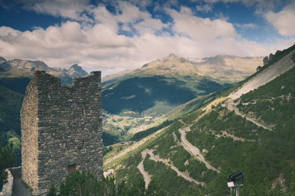 The Fraele pass and the Fraele valley are also the the border between the Ortler & Livigno Alps so we enter a new mountain group by walking over the Fraele pass. The further trail follows above the Viola Bormina valley on a flat forest road until the small settlement Arnoga. Watching over the valley the highest peak of the Livigno Alps Cima de Piazzi is always present but its peak covered in clouds most of the time.
 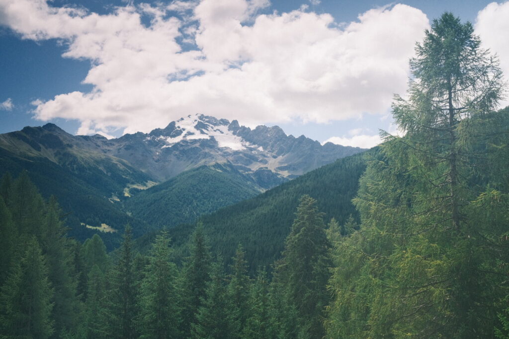 After Arnoga the forest road ends and is replaced by a forest trail going further into the valley. After a long flat walk over more than 15 kilometres the trail crosses the Viola Bormina river on a u-turn to follow uphill into the Verva valley. Walking on a mountain road with a minor incline we are getting closer to the Passo di Verva while passing directly below the Cima de Piazzi. From the pass one could climb up to its peak but not today as snowfall and a cold wind welcomes me when I arrive on the pass and I decide without longer discussions to continue directly with the downhill walk through the Grosina valley. Still following the mountain road every now and then a 4WD car crosses my way. On the idyllic lake Acque Sparse which is surrounded by many larch trees and high mountains I rest for a short moment but the cold winds are not too inviting. The last section of today brings me down to the charming & laid back settlement Eita located in the beautiful upper Valgrosina valley.
 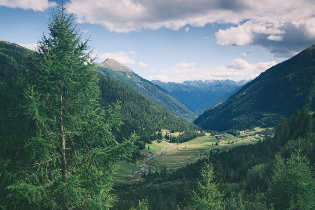 I spend the night in the rustic Rifugio Eita which I loved from the very first moment.
Day 5: Eita-Lago di Malghera
| Distance | Up | Down | Time |
|---|---|---|---|
| 16km | +1450m | -850m | 5h |
Today we climb into the Avedo valley all the way up to the Vermolera pass the third highest in the Livigno Alps which brings us to the Sacco valley.
It is another bitter cold morning even on 1700 metres here in Eita. After a short descent following the Valgrosina valley we directly ascent into the Avedo valley on a mountain road until the Vermolera alpine pasture where you can find a fountain with drinking water. From here I follow a walking trail up to the Laghi di Tres and from there to Lago Venere. It is a lonesome walk and I do not run into any orher walkers during through the valley up to the pass. After the Lago Venere the path gets significantly steeper and the final section to the Vermolera pass scrambles up through a couloir on a narrow path and through a field of big rocks. Watching back during the strenuous climb a wonderful view to the mountains of the Livigno Alps and all the mountain lakes are rewarding for the sweaty effort getting up here. 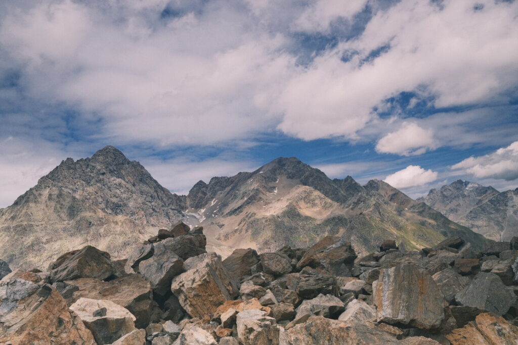 And then finally arriving at the top a first unexpected glimpse to the Bernina group and Piz Bernina the only mountain over 4000 metres in the Eastern Alps in the far distance. The way down from the pass is far more pleasant and leads soon into a green plateau populated by cows and down to the Pian del Lago with a beautiful lake.
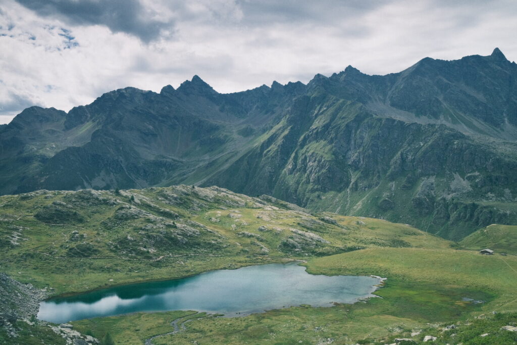 Close to the lake a Bivacco invites to spend the night in this charming environment. Instead I descend further into the Sacco valley which brings me to the small settlement of Malghera. From here I will say goodbye to the Via Alpina route and go directly over the mountain into the Poschiavo valley. This will save me around 40km and up two days of walking around the outer range of the Livigno Alps. A further 1 hour climb leads up to the Malghera lake and a tiny stone house Bivacco. From here it will be a cat jump up to the Malghera pass to reach the Poschiavo valley in Switzerland and entering the Bernina Alps.